Apple iOS 6 Maps cuts Google's exclusive lock on directions, opens door to third party apps
 Daniel Eran Dilger
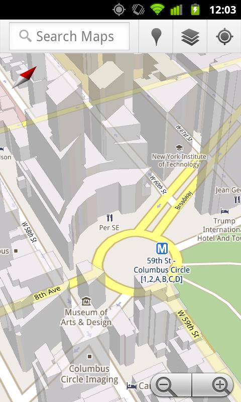
Apple's strategy of taking its Maps solo in iOS 6 was initially described in Apple wants to wipe Google off the map with iOS 6, while a second segment detailed how the company will be leveraging vector graphics to greatly improve the Maps experience in iOS and a third segment outlined how Apple is adding 3D Flyover features to displace Google's Street View.
Apple gives Google directions to the door
In the area of directions, Apple is similarly cutting Google out of its prime position as the exclusive source of iOS Maps directions. As noted previously, Google itself introduced the new Maps Navigation for Android 2.0 in 2009, with a series of new mapping features including voice prompted, turn-by-turn navigation features; voice search; searching for items along a plotted route and 3D models (below).
Apple initially appeared set to adopt those features as it had with Street View in the previous year. In late 2009, a Google spokesperson told AppleInsider, "Apple is a close partner. Millions of users experience Google Maps on the iPhone. We will continue to work with Apple to bring innovation, including Latitude and Navigation, to users but you'll have to speak to Apple about availability."
However, Apple never added Google's Navigation features to its own iOS Maps client, instead shunning them along with Google Latitude, Places, 3D models and subsequent other map enhancements that Google hoped Apple would spread across its iOS user base. Instead, though a series of acquisitions and partnerships, Apple built a complete in-house replacement for Google's maps and all of its related services.
Driving directions
For driving and walking directions, Apple appears to be drawing information from GPS and map provider TomTom, which itself includes a long list of regionally-specific licensing deals under iOS 6 Map's acknowledgments.
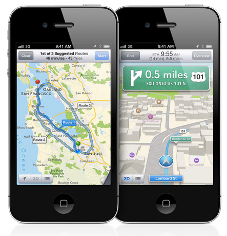
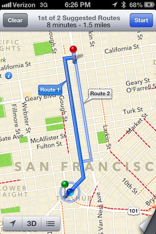
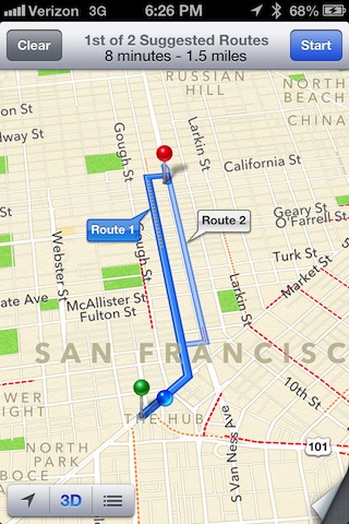
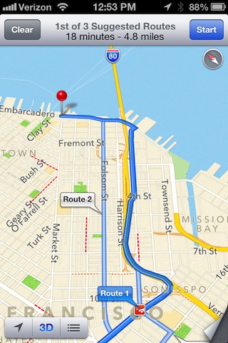
When you perform a request for driving directions, Apple presents a few alternative paths to choose from, just as it does in the current maps. You can explore this selection of driving routes, freely panning around, rotating the map or entering 3D mode to compare each of the suggested paths.
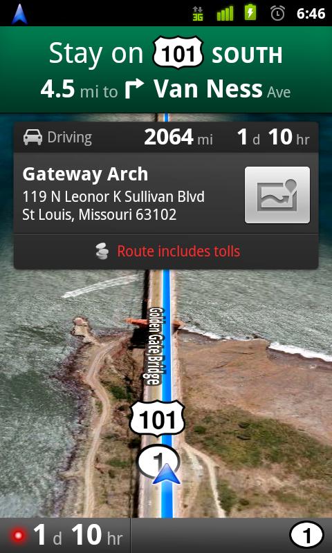
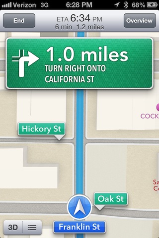
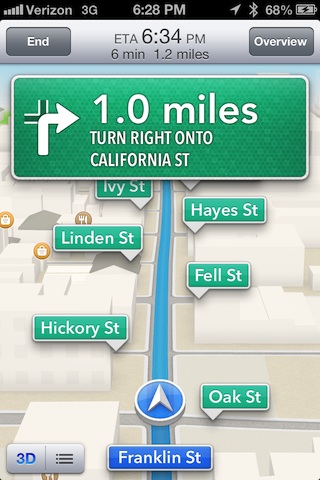
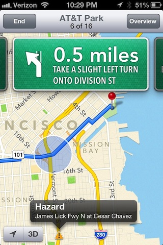
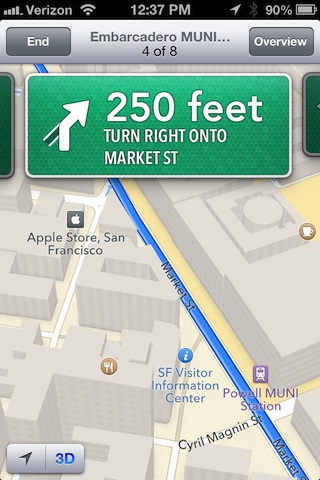
Once you select a given route and click Start, Maps jumps into its turn-by-turn mode, with the voice of Siri audibly guiding you along the path. You can at any point toggle between 2D and 3D views (shown below). Nearby road names are called out in large "street sign" banners, reducing the need to zoom in or look in detail at the map while plotting a course in your car. Ideally, you would follow the path via Siri's voice rather than watching the screen, something that the new Maps finally makes possible (and which Google has supplied for Android since 2009).
Once in turn-by-turn mode, you can't arbitrarily pan around or rotate the map because the view is updated dynamically as you move along your route, following the GPS. You can zoom in and out, but not very much.
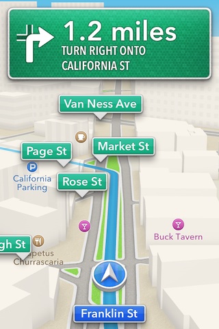
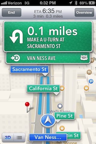
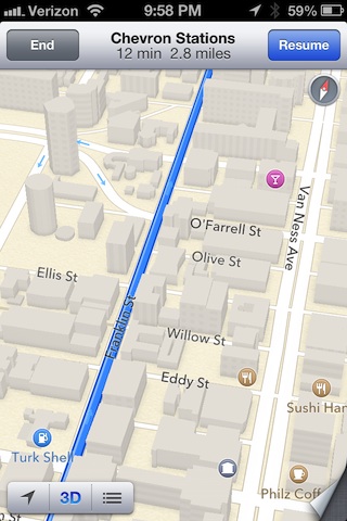
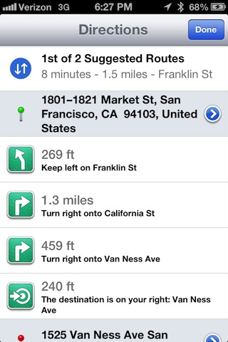
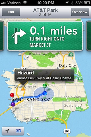
This means that once you start, if you want to preview an upcoming segment on the path, you either have to zoom out enough to see it (and the zoomed out view is limited to showing only a roughly four to six block radius) or switch to the Overview mode (below left, which supports the same free exploration of the 2D or 3D map, along or outside of your route) or Route Overview (below right, which provides a descriptive listing of turns).
You can exit the Maps app while a path is being navigated; when you do, iOS provides a green "touch to return to Navigation" banner, similar to a phone call, voice recording or other background task.
On page 2 of 3: Siri Integration, Live traffic information
Siri Integration
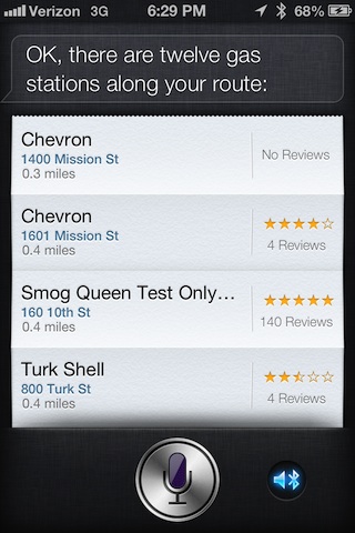
Unsurprisingly, when you ask Siri about nearby locations or for directions, you can jump right into Maps to find your way to there, with Siri voicing your turns along the way. And conversely, when you ask Siri about nearby locations (such as a gas station) while being directed to a destination, Siri will respond with results along your path (below)
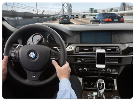
This integration is the basis for Apple's "Eyes Free" initiative to enable car makers to delegate navigation and related features to a linked iOS device, operating in Siri's voice-only mode to avoid visual distractions while driving.
Live traffic information
Along with suggesting alternative driving routes, iOS 6 Maps also tracks real time traffic information and updates its estimated arrival time dynamically as this data changes. In the case of an accident or change in traffic, Apple says Maps will suggest route alternatives along with way, too, just as dedicated GPS systems do.
Similarly, if you take a different turn than what is suggested, Maps will recalculate a new path. Apple first revealed its plans for "collecting anonymous traffic data to build a crowd-sourced traffic database" in April of last year, noting that it planned to launch an "improved traffic service in the next couple of years."
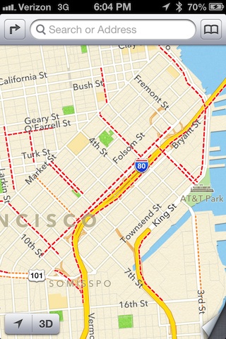
The new iOS 6 Maps in development already demonstrates the beginnings of this new infrastructure with red highlighting on the map where traffic is moving slow (below left), and indicating traffic issues along alternative paths before you being your trip (below right). Once the installed base of iPhone users migrates to iOS 6, Apple will have tremendous amounts of real time data to present and use in calculating routes for Maps users.
On the flip side, Google will also begin losing the constant updates it gets from iOS clients, forcing it to rely on the subset of Android users who get their data from Google. It's noteworthy that a variety of Android devices are already hardwired to alternative mapping systems, including the recent mapping partnership between Amazon and Nokia.
On page 3 of 3: Walking & Transit directions
Walking directions
Walking directions are different from driving directions in a few respects. First of all, the given path is actually sensible for walking, rather than just being the driving route with a longer estimated time.
Secondly, similar to Overview mode in driving directions, you can navigate around the map to any point along your highlighted route or explore around to view anywhere else you want to look at (noting live traffic alerts, below). There's also the standard Location button to jump back to your current position, or, when touched a second time, enter compass mode to show your current facing location on the map (as existing Maps work).
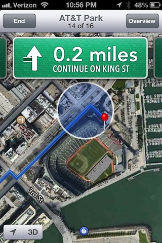
You can also preview each segment of your walking route by swiping through the series of "street sign" turn indicators. You can also activate 3D mode (below left) or even Flyover aerial views (below right) and zoom in to get a sense of what buildings and other landmarks you will be (or currently are) walking past.
Unfortunately, there's no single button to push to toggle between walking and driving modes; you have to end one set of directions and calculate the new route, which feels like a hassle but realistically just amounts to three taps: the End/Cancel button, the Directions icon, and then new mode you want to enter: walking, driving or transit.
Transit directions
Apple's new iOS 6 Maps doesn't handle transit directions natively any more. In June, Apple's iOS software chief Scott Forstall explained why, when he told developers at WWDC:
"When building Maps, we looked around and realized the best transit apps for metros, for hiking, for biking, are coming from our developers. And so instead of trying to develop those ourselves, we are going to integrate and feature and promote your apps for transit right within the Maps app in iOS 6."
And so, for the first time since the debut of the iPhone, when you look up transit directions in Maps you won't be automatically directed to Google. Instead, you'll have to select third party helper apps to provide these types of alternative directions. The way Apple has implemented this allows third parties (including Google) to all compete for you attention, resulting in a more level playing field, more options, and competition for features and accuracy.
Currently, Google relies on its own internal algorithms to calculate transit directions in a wide variety of cities. While Maps is limited to transit-only directions in iOS 5 and earlier, Google also has data on how to bike around or hike off-road paths. None of these have ever been visible in iOS Maps, however. Now, if Google chooses to, it can (as can others).
Being able to pick your own specialized third party sources for transit and other transportation modes is great because Google's aren't always the best. In San Francisco, for example, the local Muni system of busses, trains and cable and trolley cars actually provides public "NextBus" realtime arrival data that is generally quite accurate, using GPS devices outfitted on each vehicle. But Google doesn't use this data for some reason.
The result is that if you compare Google's information on the next available Muni bus with any third party apps that do tap into this system, you get very different data (with the potential difference of getting to work on time or not).
However, until now there hasn't been any way to tell Maps that you prefer routing information from a source other than Google. In iOS 6, you'll now be able to look up a variety of apps capable of providing specialized directions for specific areas, and integrate them into the options available in Maps, without having to switch between each app to compare the routing information it has. Of course, because iOS 6 isn't out yet there's no way to search the App Store for Maps-savvy options (options are currently blank, below).

Rest assured that the wide range of transit, biking and hiking apps will jump on the opportunity to compete with Google for your attention. There's also the potential for linking other transportation modes into Maps, enabling specialized routing information options ranging from navigating a mall to charting a path across a ski resort to possibly even finding the cheapest route between cities when deciding between flying or taking a train.
As Forstall noted to developers in the audience at WWDC, "registering as a routing app gives you more opportunities to get your app in front of users. Routing apps are not limited to just driving or walking directions. Routing apps can also include apps that provide directions for the user's favorite bicycle or hiking trail, for air routes, and for subway or other public transportation lines."


 Christine McKee
 William Gallagher
 Andrew Orr
 Sponsored Content
 Malcolm Owen