Apple now labeling map data collection vehicles in the US, UK
 AppleInsider Staff
Spotted in Seattle by AppleInsider reader Fred Taub.
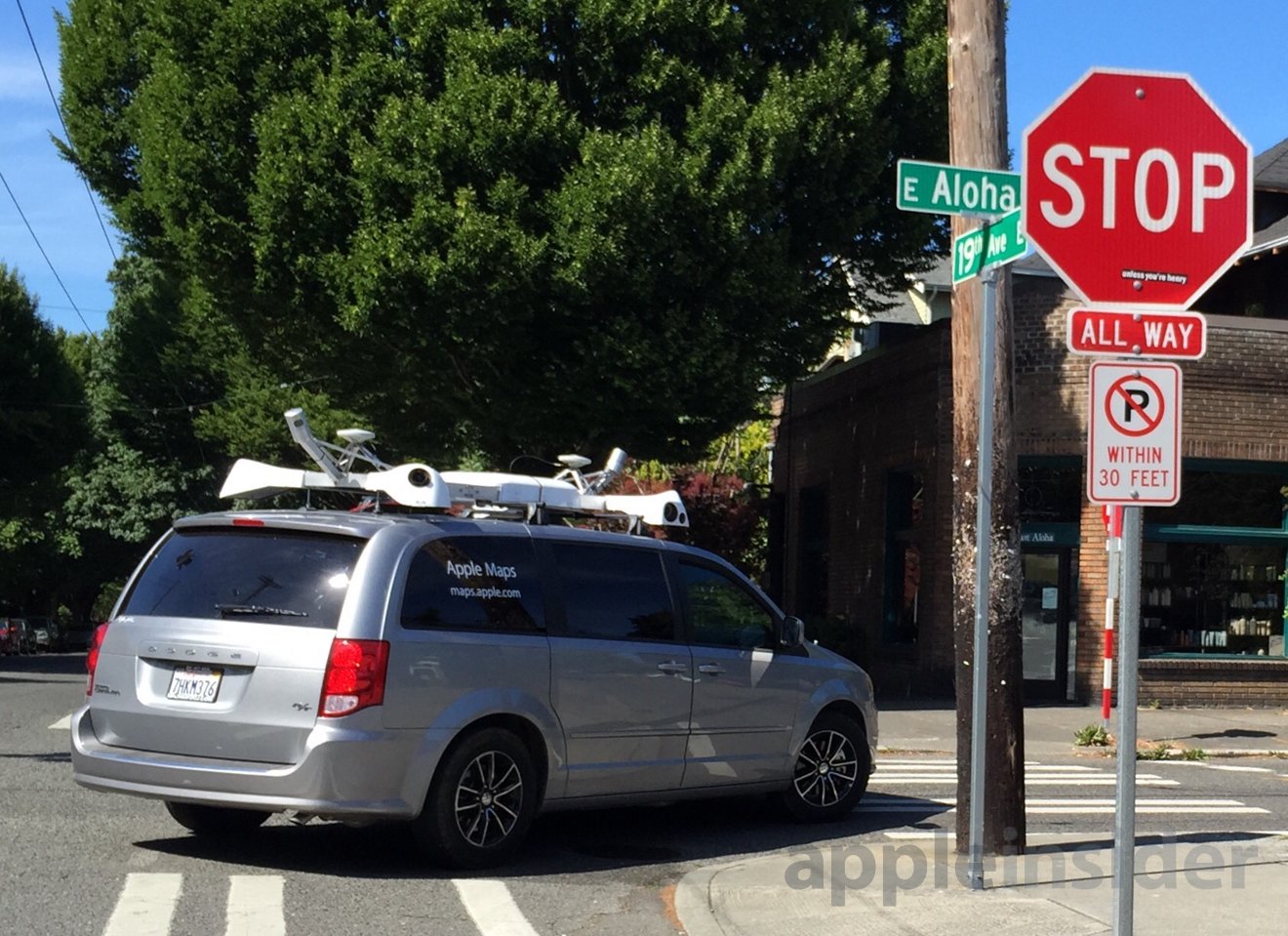
Weeks after officially confirming the existence of a real-world data collection effort designed to bolster its mapping service, Apple has updated its fleet of sensor-loaded minivans with branding that makes them more clearly identifiable.
The minivans now sport a simple "Apple Maps" decal along the rear quarter panels, with the address of Apple's Maps microsite below. Both decals appear to be set in Myriad, Apple's marketing typeface of choice for years.
Apple affirmed the program's existence earlier this month with a new website that explains the purpose of the formerly-mysterious vehicles that have been spotted around the world for months. The company says data collected "will be used to improve Apple Maps," and provides an up-to-date list of locales where data will be collected in the immediate future.
When the vans first appeared in February of this year, many believed they were acting as testbeds for a secretive Apple autonomous vehicle project. While AppleInsider has reported the existence of such a program in a Silicon Valley suburb, the vans are not used for that purpose.
Instead, as we outlined in February, the vans are designed to collect detailed three-dimensional mapping data that will likely be used to improve Apple's 3D Flyover feature with new capabilities akin to Google's Street View. Apple has continued to invest in new technology for Maps in recent months, acquiring high-accuracy GPS firm Coherent Navigation and augmented reality company Metaio in May.


 William Gallagher
 Andrew Orr
 Sponsored Content
 Malcolm Owen


 Mike Wuerthele