Apple Maps picks up public transit directions for Denver, Colorado
 Roger Fingas
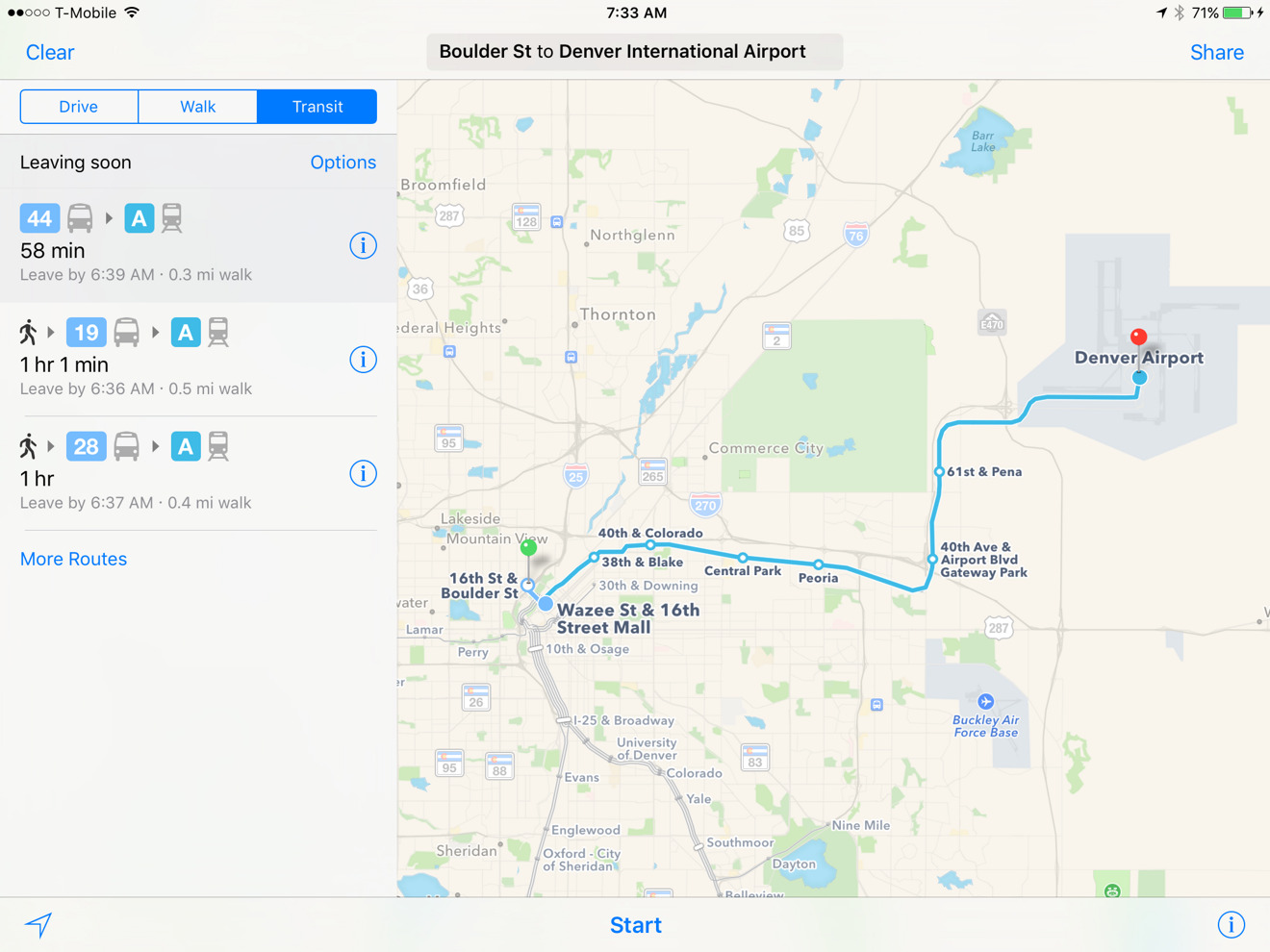
Apple on Monday introduced public transit directions for Denver, Colo. to users of its Maps apps for OS X and iOS, continuing a slow expansion of support.
Denver residents can now use Apple Maps to get around the city's bus and light rail systems. As normal, the app will mix-and-match transportation methods as needed, and provide multiple route options where possible.
Although Apple restored transit directions to Maps with 2015's iOS 9 — having stripped them out in iOS 6 as a part of ditching Google content — the company has been relatively slow to grow coverage. Most of the cities Apple supports are located in the U.S. and China, and even within its home country there are still significant gaps.
Nevertheless, Apple has been gradually adding more locations throughout 2016. Some recent additions include Atlanta, Miami, Montreal, Rio de Janeiro, the Australian state of New South Wales, and regions serviced by the U.K.'s National Rail.
The iOS 9 feature guide has yet to be updated with many of the recent changes, but has regularly lagged behind actual support.
Apple could be hoping to have more comprehensive transit directions by the time iOS 10 is launched in the fall. That OS is currently in its first developer beta, and will get a public beta next month.


 Malcolm Owen
 William Gallagher and Mike Wuerthele
 Christine McKee
 William Gallagher

 Marko Zivkovic