Apple Maps vs Google Maps - smartphone mapping titans battle it out in 2020
 Wesley Hilliard
Apple Maps vs Google Maps
Apple Maps and Google Maps have both recently undergone major updates. AppleInsider takes a look at both, and examines which changes might shift which platform you want to use.
Google Maps has been the go-to king of online mapping since its launch in 2005. It started out just offering an easy way to get directions from one place to another, and has slowly evolved into an interactive global database overflowing with information. Now, it's less a mapping app and more of a sharing and data collection network.
Apple Maps launched in 2012 with a lot of noise. That noise was mostly complaints about inaccuracy and poor directions.
In the past eight years, Apple has rebuilt the entire service from the ground up — which was thought an impossible task given its launch. As of 2015, Apple Maps became the most used navigation app on iOS. This occurred because it was the default map app on iOS — but as Apple continues improving its maps app, users might be there by choice.
Apple Maps
At its launch, Apple Maps saw many issues with rendering and navigation intelligence. It was mostly blamed on them trying to combine too many resources into one mapping app. What got Google Maps where it is today is its vast amount of data its gathered from its own sources, which Apple just did not have in 2012. After a few redesigns and a lot of behind the scenes work, Apple finally unveiled their new Maps app running entirely on first party sourced data.
New Maps
Over the past few years, mapping vans have been driving around the continent with giant radar equipment and Apple employees have been wandering the streets with additional radar strapped to their backs. This resulted in the United States getting a new and much improved maps database. While some locations still require more data for things like the new "Look Around" mode, very similar to Google Street View, all locations have the latest mapping data from Apple now.
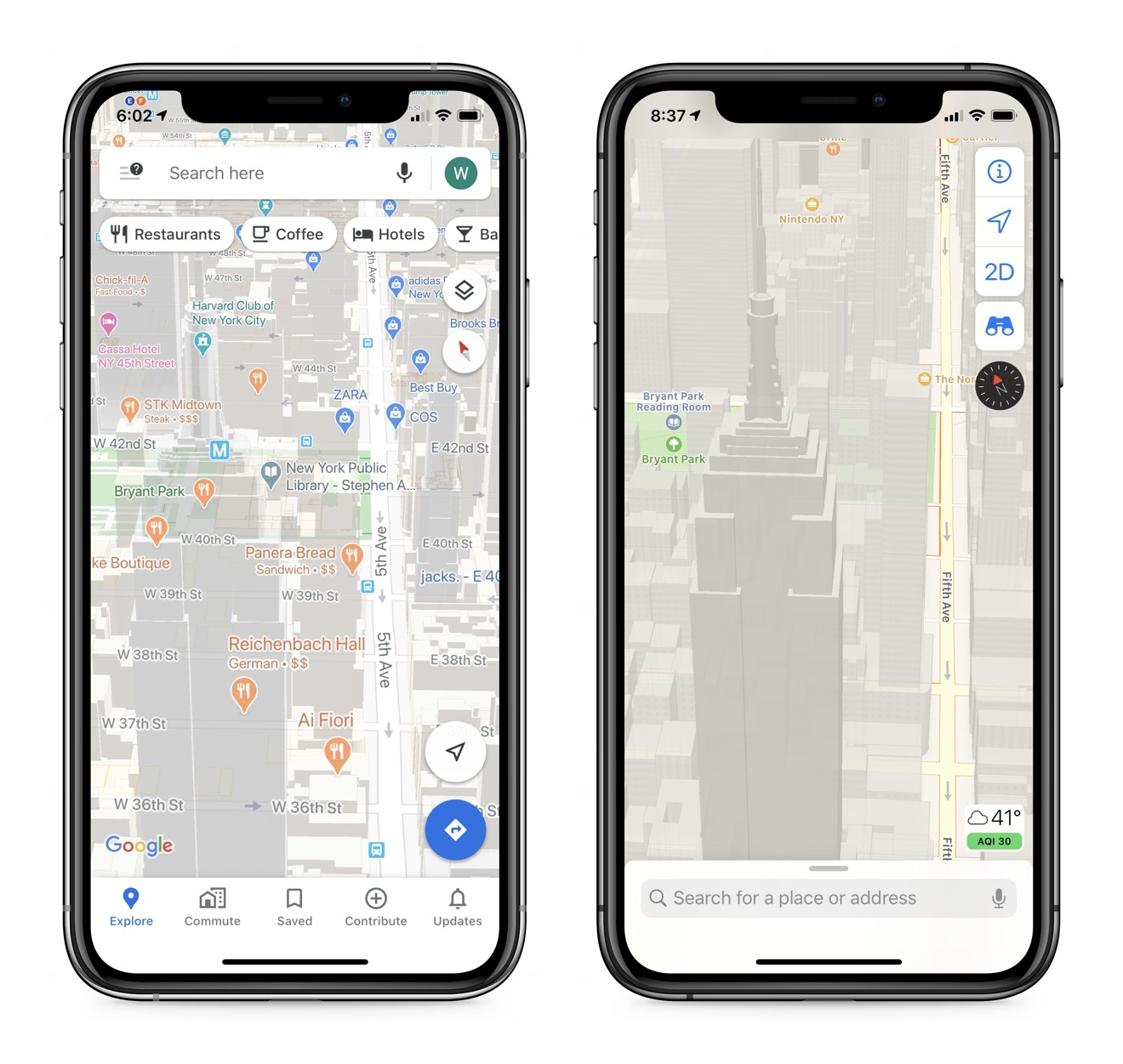
Apple Maps presents its data in a clean, easy to read format, which is designed to show only what is needed on the screen for what the user is doing at that moment. A lot of smart tweaks to the interface allow for you to pan around an area and have interesting interactions and data present itself.
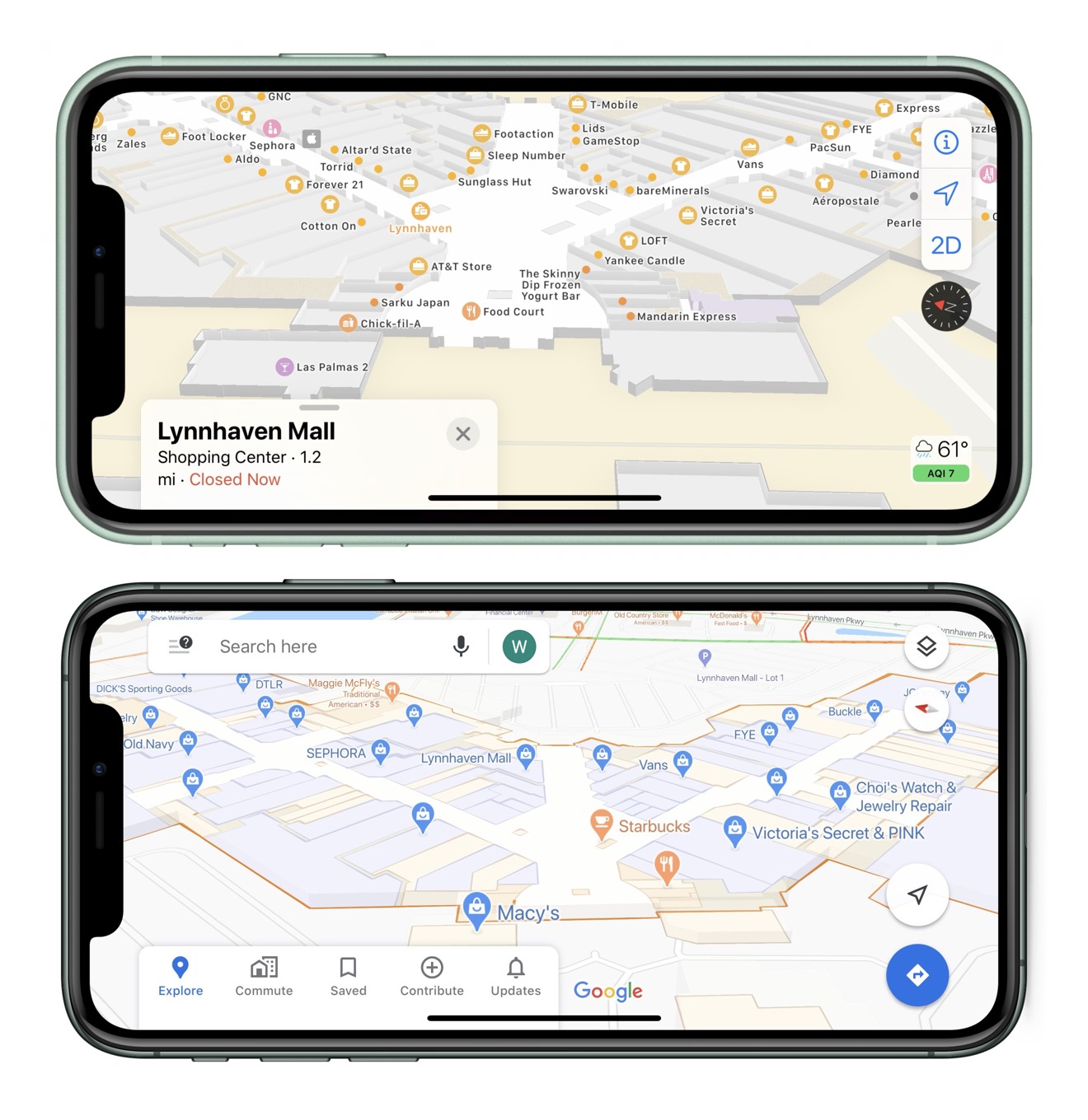
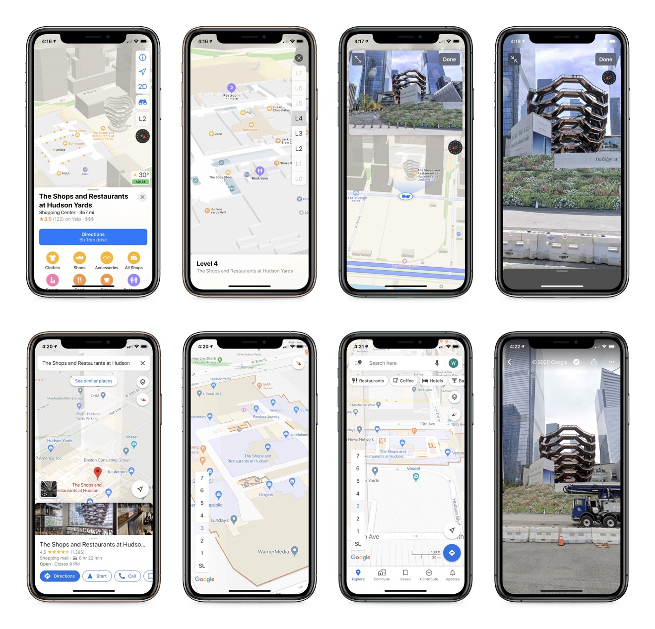
For example, if you hover over an indoor mall thats been mapped by Apple, a new interface will show up offering for you to browse the location. This new interaction shows up for a variety of local areas, but has not populated for every mall or indoor business.
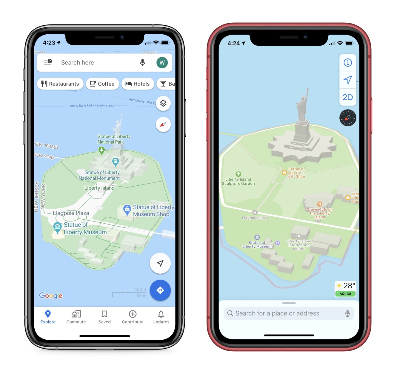
One design standpoint of Apple Maps is its 3D presentation. As you pan around an area, if you've zoomed in close enough, the outlines and shapes of buildings will render in 3D in real time. Even statues and unique buildings render in this way, and from my exploration of my very quiet hometown in Tennessee, they've done this down to the smallest dwellings.
Enable satellite mode in Apple Maps, and more population dense regions like New York or San Francisco will have the satellite imagery overly the 3D models. This is very similar to how Google Earth attempts satellite rendering, but this mode is built into Apple Maps, and allows for features like 3D tours of cities.
Another unique design feature is how Apple handles labels and landmarks. Any famous tourist attraction or landmark has a unique 2D icon to represent its location. This make navigating somewhere like New York a breeze, since from a broad overview you can easily spot all the landmarks juxtaposed over the landscape. This is opposed to Google using a generic star marking a unique location.
Software Features
Apple Maps is also a good iOS citizen, for obvious reasons, but in ways Google could benefit if they ever bothered implementing the features. Dark mode works based on system settings, even when not actively navigating, unless in CarPlay, which relies on the cars own ambient light settings. Siri is fully featured and works well with basic navigation commands and specific locations like "my Mom's house" or "my friend Jeff's." Maps is also used across the OS, like in Apple Photos for location history.
The latest features in Apple Maps are simple, and most come from the new data provided by Apple's updates. You'll now see stop signs and red lights as you drive, and walking directions will take you to the entrance of a building rather than just a street corner. Look Around let's you see an area from the street, but in a very smooth dreamlike way, and navigation is with a simple tap. When in look around you can move around the street in a granular fashion, and run into invisible walls with haptic feedback, much like a video game.
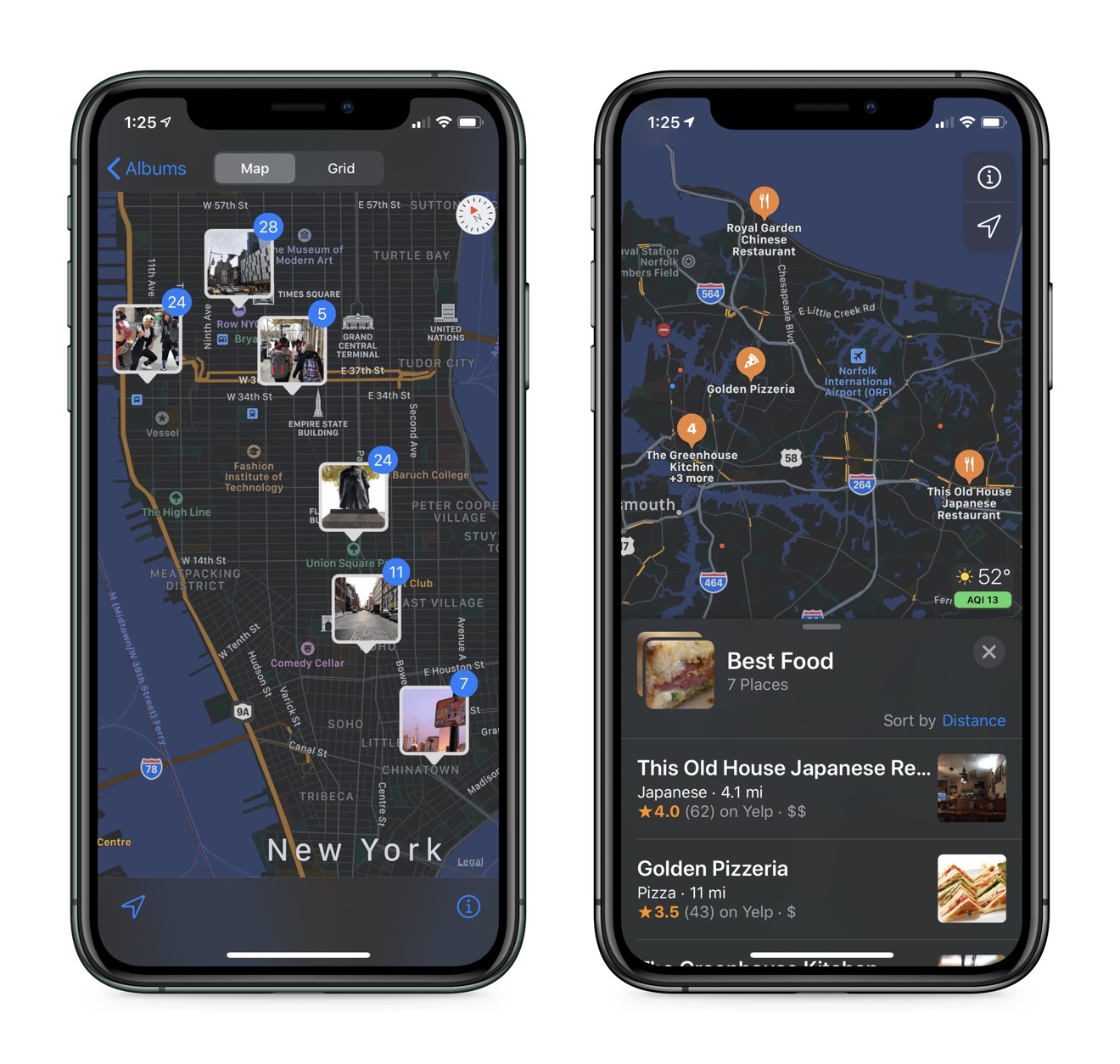
Collections are a part of the iOS 13 maps update, which allow users to make lists of locations and sort or share them. This is a feature that can be difficult to find a use for, but has come in handy over time. For instance, I was house hunting and was able to make a Collection of everywhere I wanted to check out, sort it by distance, add custom names, then share it with a friend. I have also made lists of favorite local restaurants, perfect for sharing with a friend new to the area.
One last feature that is one of those hidden iOS gems that Apple should spend more time discussing; Apple Maps and Siri Intelligence. Basically, because of how iOS uses machine learning to connect data points across all the built in apps, users can benefit greatly from having a well maintained local database. Contacts, Maps, and Photos all work together in the background to create a shared information experience that is mostly invisible to the user until a request for that information is made.
For example, you have a contact for your friend, and you've done the work to save their home address to the contact card. In Maps, this person will show up as a location you can navigate to when searching. In photos you can label faces using existing names in contacts as a preset, and when you do this, you've tied a stack of photos to a contact card, which has a home address. When Siri generates a new photos memory of that person or location, it will be a memory populated with their name; some thing like "Jeff's Home over the years."
That is just one example of how iOS and machine learning ties all of your data together without storing it in a cloud or using it for advertising revenue. Which leads us to privacy and Apple Maps. The above example is a result of data provided by the user across several system apps meeting in a fashion useful to the user by creating a memory based on a person and location. All done privately and on device, which is not how Google handles similar features on iOS.
Privacy and Data Collection
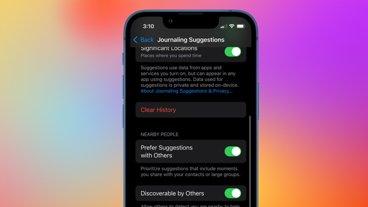
In addition to this use of machine learning, Apple Maps also maintains user privacy when searching and navigating the Maps app itself. When a user navigates from point A to B, Apple will generate live navigation by sending the request to the server utilizing a random identifier. When this is done, the server does not receive a request for A to B, its given multiple requests across multiple identifiers, masking the original request behind different start and stop points. This is all invisible to the user, but privacy is maintained and Apple has no ability to assign significance to the users query.
Users do amass a large amount of location data and history when using such features, but its kept in a local history for your on device Siri to learn from as you use your device. If you want to erase this history and reset your identifier manually, you can do so at any time in settings->general->reset->"reset location and privacy."
Data Sources and Reporting Issues
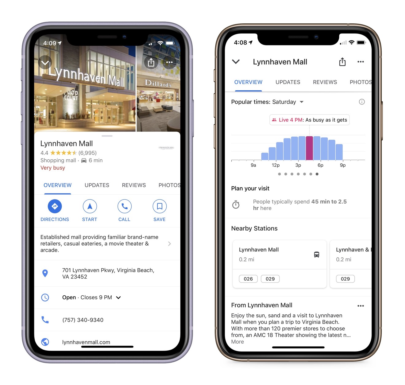
Apple Maps is great at navigation and presenting user data, but its also full of other information as well. Apple has long used Yelp, Wikipedia, local business data, and road and safety data to add to the Maps experience. When looking at a location, most of the business information, photos, and reviews all come from Yelp. You can also see if a location accepts Apple Pay, takes reservations via Open Table, or has a connection to iMessage Business Chat from the top menu. Scroll to the bottom and you'll see options to add a location to a contact, which will personalize the data for Siri and other system uses, or notify Apple of incorrect data.
When reporting an issue, a new UI pops up with all of the data fields already in use by a location. From here you can change where the map pins the location, change the name and address, update business hours, indicate a closure, add photos to support your claim, and a way to describe more detail at the bottom. This sends an email directly to the Maps team, and is addressed in some time after sending. My experience using this feature has varied, but has generally been within two weeks to a month for a full fix on an issue, and that was before the update.
As you can see, Apple Maps is dense with features and data that can help a user across many needs, and even in other apps on their device. Apple takes a strong stance on privacy and provides all of this data and tools without compromising the user. It is a built in app that most will default to out of convenience, but its latest updates show quite the strong platform that should not leave users wanting.
Google Maps
Google Maps started as the only navigation option on iOS for iPhone. For years it lived on every Apple device as one of the few non-Apple apps pre-installed on the phone. As Apple sought to separate itself from Google, their relationship ended in 2012 with the launch of Apple Maps. A short time later, after the poorly received Apple Maps fell flat, Google Maps returned to the App Store and took hold as the go to for third party navigation.
New Update
Google has ushered in its 15th anniversary with some UI tweaks and new features to its map app. The mapping data is consistently updated by Google and its sources, so this isn't quite the same overhaul we saw with Apple, but rather a re-emphasis on social and data sourced features with a new navigation bar. The previous tabs were simply explore, commute, and for you. We now have five tabs: explore, commute, saved, contribute, and updates.
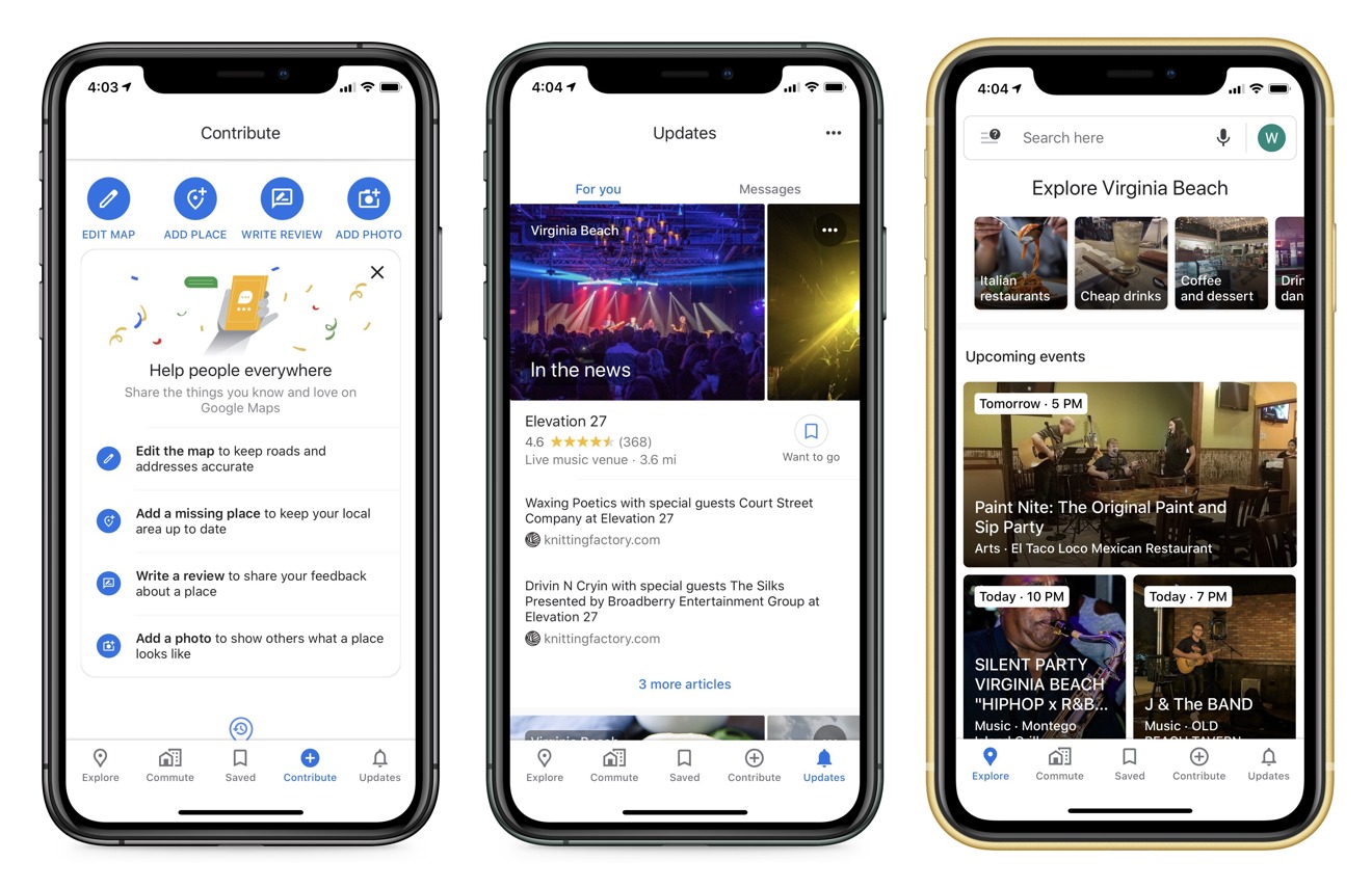
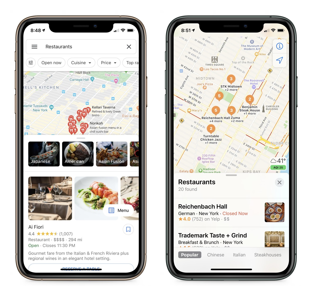
Explore stayed relatively the same with its editorialized content surrounding attractions in an area. From here you can see events generated by users and businesses, and in more populous areas, Google editors themselves will collect content for easy navigation. A lot of data is algorithmically generated based on user interaction, how long people spend time at locations, and general ratings and reviews.
Commute works the same as before, and just like before, you can't remove it even if you work from home. It is a forever button that will never help me with anything and just exists on my toolbar. For people who do not work from home, you can configure it to show you the best route to work and even consider best transit times. In this features settings you can let Google know if you ride a bike, walk, take a bus, or even ride a motorcycle and the directions will change based on your preference.
The remaining tabs come from splitting up the for you tab into parts. Saved works just like Apples Collections, but with the usual Google additions of social networking and personal data. From here you can see your favorite and followed locations, and in case you are wondering, following a location lets you see business updates in a timeline within the saved tab. For some reason you can again see the same data shown in the commute tab represented as Home and Work in a label category, which I still don't know how to get more data in this tab.
Contribute is exactly what you think; user added information, photos, and updates about a location. This shows you content you've generated, and gives you the ability to edit or add more. If you'd like to add a new business or write a review about one you know, this is a dedicated tab just for that. You can also utilize this tab to edit incorrect or missing information using a built in tool that walks you through updates.
Updates shows you information about businesses around you and those you follow in an algorithmically generated timeline. This timeline is also added to by local news and influencers who write about locations. Another tab shows you all business chats you have started via Google.
Software Features
Beyond the new tabs is the same old Google Maps experience, with a few new welcome adjustments. New information included in Google Maps when looking up transit information include: temperature of the transport, accessibility features, women's sectioning if regions require, if security is onboard, and number of carriages available in Japan.
In addition to new transit data, Google finally released their new AR navigation system for walking. Now when using walking directions, you can pan your phone about and get Augmented Reality markers and information to display over the real world. This will show you the exact location to walk to, and how far it is via arrows painted in the real world. You are of course looking at this through your phone display, so it is not going to work well while moving, and should not be used while walking anyway.
You can also make use of the greater Google ecosystem to provide data to Google Maps, kind of like how I explained with Apple Maps, Contacts, and Photos before. The difference here is, instead of on device and private learning, you have to be deeply invested in Google's ecosystem. If you use Google Contacts, Google Maps, and Google Photos, you can get a similar set of ML generated photo galleries, but only if the data is in Google servers.
Google Maps has rightfully been lauded as the best navigation app on the market for years. They have 15 years of experience and data to back up their system, and even own systems like Waze, which contributes even more traffic data sourced from drivers using the app. Accuracy was always Google's claim to fame for maps, but as Apple gets more vehicles and users on the road, that is quickly becoming less of an issue for its competitor.
In order to differentiate itself, Google Maps has evolved from the navigation app it started as and has moved into a full on service encompassing a social network, news and events, reservations and business interactions, and tourist information and city guides. As Google has done with many of its other services, Google Maps has become an all encompassing one stop shop for users hoping to get data about a location.
Privacy and Data Collection
Google's entire ecosystem is built on one single concept: data collection. Search, maps, voice assistants, and self driving cars all rely on mountains of data. That means user data is one of the most valuable things they have, and is protected fiercely in their servers, at least until its not. Google does not sell personal information directly, but they build data sets based on their users and utilize that data for ad space sales.
This means you are Google's most valuable product, for your data is their entire basis for revenue.
Google Maps is a treasure trove for user data, and provides some of the most sensitive data available for advertisers. Where you go, how long you are there, what you buy, how you feel about a business, what transit you use, and who you are with are all known by Google and stored on their servers for data algorithms. Google uses differential privacy to prevent advertisers from learning about you directly, but it has been proven that with some data sets, it is easy to pinpoint who some people are anyway.
Android devices have some local computing systems to attempt to keep some data on device, but iOS does not have that privilege and all app communications are done via a Google server. Some settings can be changed by the user to limit data collection, and even a new incognito mode for Google Maps exists, but you cannot eliminate this tracking entirely without deleting the app altogether.
Google does let you download maps for offline use, which is another privacy loophole for users.
Maps compared
Apple Maps and Google Maps are both mature navigation apps in their category and are the top used mapping platforms in the world. Each have their own benefits and uses may vary from person to person. Majority of iOS users just use what is already installed on their iPhone, and many install Google Maps out of habit or preference. Stripped to the barebones needs of a navigation app, both services will get you to where you need to go without issue, but design and philosophy will drive you to one or the other.
Google has a shoot from the hip style of presentation. They give you every ounce of data that can fit on a screen in a single frame possible. While this means a user might find what they are looking for faster, this also means a user can be inundated with choice or find sifting through the data and menus daunting.
For a company that is known for consumer choice and customization, it is baffling how little of the Google Maps experience can be adjusted by the user. I will have the same five tab interface as every other user, regardless of if I have a commute to work or care about regional data updates. I cannot choose when to see day and night mode while navigating the app, and it will not respect iOS settings.
Many features present themselves behind a toggle to give Google more data, leaving some areas of the app completely barren without it.
Ads frequent my Google Maps searches — I searched for a sandwich place and was shown Mexican food as a top result due to ad placement. While it was obviously an ad and clearly labeled, it pulled me out of the experience and left me irritated at the result.
That all being said, Google Maps does offer a user, especially ones who don't mind donating all of their data, a rich experience filled with data and all the information you could ask for about a place or event.
Apple
While Apple Maps has not (perhaps just not yet) pushed into social networking or restaurant reviews, it still has a wealth of data for users to get to where they need to go. At its foundation Apple Maps is a navigation service that will present you with a user friendly map that only shows what data it needs to at the moment. Interacting with Apple Maps is clean, private, and simple and lacks all of the bells and whistles of Google Maps, but in a good way.
Finding out what business is open or how to get to Grandma's house should be an easy process without the need to feel invaded upon by data siphons and ads, and that is just how Apple presents their map solution.
Apple Maps is proprietary and only exists on Apple devices and the web. Services like DuckDuckGo have implemented their maps due to privacy stances and ease of use as well. Being a default Apple app, Maps exists across the OS and adheres to all the user interface rules set out by Apple themself, which makes the experience all the more straightforward and simple.
Apple Maps versus Google Maps in 2020
Apple and Google have both developed their respective map applications into full maturity while choosing different directions to go. Users who live in the Google software ecosystem will see benefit to using Google maps as their services intertwine more on that side of things. Apple users, and especially the privacy conscious will stick to Apple Maps for its system integration and simplicity.
Feature for feature, these two applications are very close, with Google coming out on top in volume of data for obvious reasons. Previously there wasn't much need to decide, because Google Maps simply couldn't be matched, but now there is no clear winner. It is impossible to cover every nuance and feature of these two huge platforms, but the high-level notes and changes tell us a clear story.
Apple users can choose either. Android users are effectively stuck with Google Maps. As it is with Android vs iOS, this will end with user preference and choice, and that is a good thing.


 Chip Loder
 Andrew Orr
 Christine McKee
 Marko Zivkovic

 Mike Wuerthele
 William Gallagher