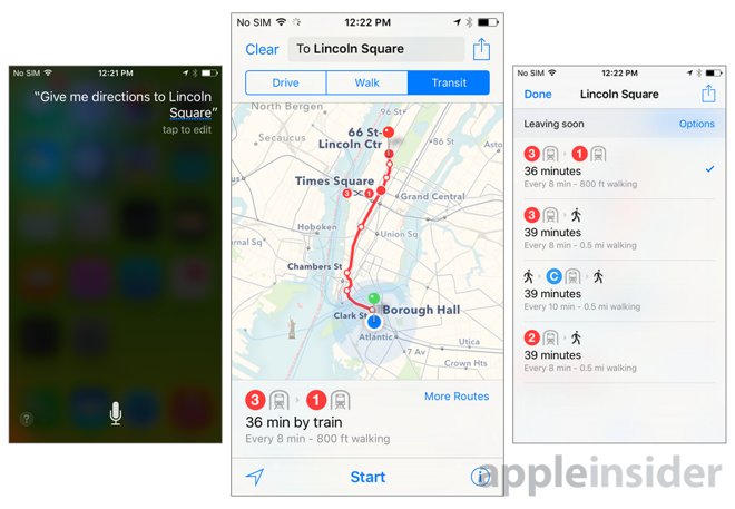
For years, the biggest omission in Apple Maps has been the lack of transit directions. But that all has changed with this year's iOS 9 update, which includes built-in support for buses, subways, trains, and more in select major cities.

At launch, transit directions are available in Baltimore, Berlin, Chicago, London, Mexico City, New York City, Philadelphia, San Francisco, Toronto, and Washington D.C. It is also available in 30 cities in China, including Beijing, Shanghai, and Shenzhen.
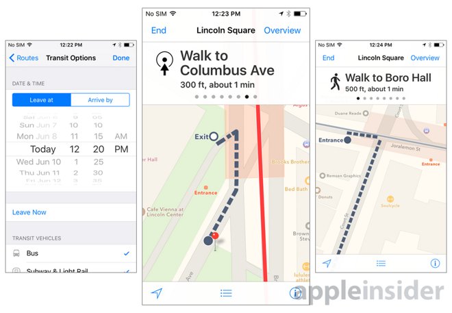
In those cities, the new transit view offers detailed directions that are customized for each location. These include specific places on the map where the subway entrance may be, or where exactly on the street a bus stop is located.
Like competing transit directions from services like Google Maps, Apple gives users a number of transit options when they search for a location, including different train routes and departure times. Where available, Apple Maps includes the schedules of incoming trains.

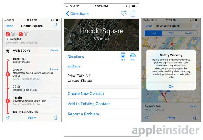
Directions can be seen in both a map view and a step-by-step list view. In the detailed list view, users can also check to see every stop along the way, to aid them in their trip.
One feature unique to Apple Maps in iOS 9 are underground maps, which show a sort of bird's eye X-ray view of underground train stations. With this, Apple can show travelers exactly where they should go and where they can exit a subway station, for example.

Users can also schedule future trips with Apple Maps by entering a custom departure time and date, and the system will give users the best possible routes available at that time. Types of transportation can also be included or excluded, such as for those who may not wish to take the bus or subway.
Transit directions in iOS 9 are also compatible with Siri, which means users can simply speak to their iPhone to get the proper directions. Support for Apple Maps transit will also be coming to OS X, meaning a user can plan their trip on their Mac and then follow the route on either an iPhone or Apple Watch.