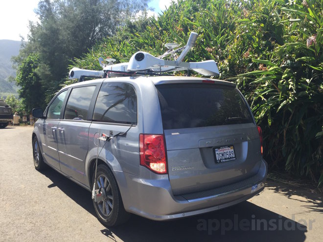
Apple has updated its street-level vehicle-mounted photography site, and in addition to efforts continuing all over the U.S. and overseas, vehicles associated with the project are now cruising streets in Connecticut.
First spotted by MacRumors, Apple's "Street Team" has expanded its efforts to the New England state for the first time, making it the 34th state that the company is known to have collected data in. As with all the other locations it has patrolled, Apple will blur faces and license plates on imagery it takes prior to publication.
It is not clear what Apple will ultimately use the data for. Apple's mapping vans have appeared in locations prior to expansion of transit data in Apple Maps, so it's possible that Hartford or New Haven, Conn. may see addition of the data in coming months.
Speculation exists that the data is being collected to aid in Apple's autonomous driving project. However, Conn. has a ban on autonomous vehicles, so it would seem more likely that a focus for early driving system intelligence gathering would be in states that allow autonomous cars to be tested on its roads.
The Apple site listing mapping van patrolling locations was last updated on April 10. It appears to be getting updates about once a month.
The vehicles will be in Fairfield, Hartford, Litchfield, Mittlesex, New Haven, New London, Tolland, and Windham counties between May 8 and May 21. Its efforts in other states and internationally continue as well.