 Mikey Campbell
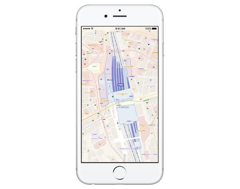
Apple in a recent update to its Japanese website confirmed local transit data will arrive in Maps when iOS 10 launches this fall, further expanding the feature's reach into Asia.
The forthcoming feature addition was quietly announced in an update to the Japanese version of Apple's iOS 10 preview webpage. When Maps debuts this fall on Apple's next-generation operating systems, which also include macOS Sierra and watchOS 3, customers in Japan will be able to search for public transport options, compare fares, view subway station maps and more, the company says.
As noted by blog Ata Distance, a screenshot of the feature shows a bird's-eye view of Shinjuku Station in Tokyo, complete with train lines and the locations of entrances and exits, suggesting initial availability will include Japan's capital.
Launched last year as part of iOS 9, transit capabilities have been slow to roll out. Currently, availability is limited to large metropolitan areas in the U.S., as well as select cities in Australia, Brazil, Canada, China, England, Germany and Mexico. Japan is not yet on Apple's list of supported countries.
Transit in Apple Maps aggregates data from outside sources to provide users with route information, departure times and other information for buses, trains, ferries and more. A similar feature has been available from Google Maps for years, but Apple is attempting to play catch-up.
Unique to Apple Maps are top-down views of underground subway and train stations, as well as graphics that match local road signage. Apple says the extra information helps users plan a more efficient commute, and is especially useful when traveling to unfamiliar cities.


-m.jpg)


 William Gallagher
 Christine McKee
 Andrew O'Hara
 Mike Wuerthele


 Malcolm Owen


8 Comments
You can tell which cities Apple is working on because the station outlines start appearing. In addition to Japan, also Vancouver, Dallas, Houston, San Diego, Pittsburgh, São Paulo, Singapore, Paris, Madrid, Rome, Milan, Prague, and most of the UK. No idea about the order or timeline, but I would expect the NA cities sooner as that has been Apple's focus so far, and their transit systems are less extensive and therefore less time consuming to map every station entrance and exit..
日本の交通機関がまもなく到着します。 マップで乗り換えの検索や、運賃の比較ができるようになります。地図上には、地下にあるすべての駅や線路と、大きな駅をつなぐ連絡通路も表示されます。 On Apple Japan, translates roughly to: Japanese transportation will arrive shortly. Search and of the transfer in the map, you will be able to compare fares. On the map, and all of the station and line in the basement, it will also be displayed walkway that connects the large station.
At last.
I wonder if it is too late though. Google Maps with transit has been eating Apple's breakfast, lunch, and dinner here for 4 or 5 years.
Hey Apple, when will this arrive to the most European cities?? And if you are unable to bring Apple Pay after 2 years, why the hell do not release the NFC for letting us using the bank apps like in Android?