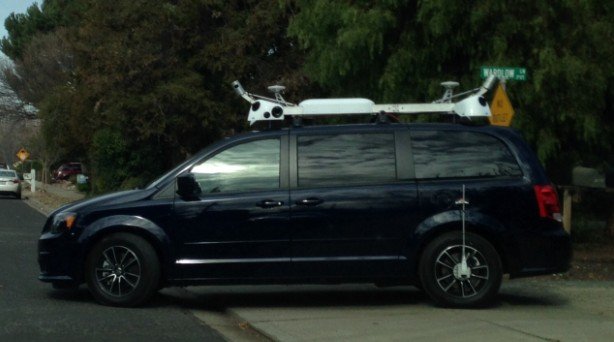
A number of minivans with what appears to be camera equipment and a LiDAR sensor mounted to the roof that have appeared around California in recent weeks could be part of a new Apple project, as at least one of the vehicles is registered to the iPhone maker.
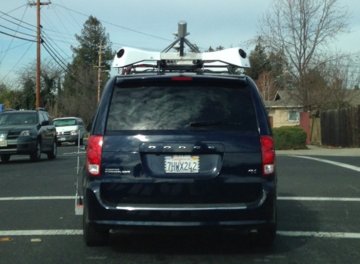
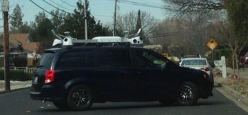
The minivans sport an X-shaped frame mounted to their luggage racks, with dark recesses that likely house cameras at each corner. The California Department of Motor Vehicles confirmed to San Francisco CBS affiliate KPIX that a blue Dodge Caravan spotted with the equipment was leased to Apple.
Along with the cameras, a pair of spinning cylindrical devices fitted to the front and rear look to be LiDAR sensors. LiDAR is a laser-based technology used to make high-resolution maps, and also forms an integral part of the sensing systems on self-driving vehicles, including those developed by Google.
Analyst Rob Enderle told KPIX that he believes the vehicles are in fact self-driving cars, but that is an unlikely possibility given that Apple has not been issued a testing permit for those purposes. It is more likely that Apple is preparing to begin a mapping program similar to Google's Street View data collection initiative.
Two small disc-shaped antennas are also fitted to the roof, as well as a sensor hanging over the rear wheel that could be used to more accurately measure movement as indicated by the rotation of the wheel. An almost identical white van with California license plates was spotted last September in Brooklyn.
Enderle noted that the number of cameras on the minivan — Â there appears to be at least 12 — Â seems to be a high number for a mapping vehicle, but Google's latest-generation Street View cars use a ring of 15 5-megapixel CMOS sensors. Aside from the physical configuration, the equipment on the Apple-registered van appears to be broadly similar to the technology fitted to a Street View car.
Apple is known to have ambitious plans for its mapping service, and collecting street-level data is one of the only ways to ensure quality. Google's Street View program is widely cited by industry experts as a primary driver of Google Maps's accuracy.
Thanks to AppleInsider reader Jason for the tip.
 AppleInsider Staff

-m.jpg)





 Oliver Haslam
 Thomas Sibilly

 Marko Zivkovic
 Wesley Hilliard
 Malcolm Owen
 Andrew Orr


-m.jpg)



98 Comments
I predict five to fifteen new troll accounts whose only posts regard Google “doing it first” regarding street-level photography.
Then again, this is probably just Apple’s self-driving car, set to go to market in Fall 2016, completely obliterating Google’s timeframe.
I really hope they are adding street views. The Maps Flyover feature is useless. They should have invested in street view instead.
Thing is, this’ll probably result in an enhanced Flyover. Since planes can’t get low enough to, well, get between buildings and see the street, they’ll likely composite these images into Flyover to let you zoom in further.
This is wild. I was behind one of these on my way to work this morning. Didn't know what it was [IMG]http://forums.appleinsider.com/content/type/61/id/55052/width/200/height/400[/IMG]
This article had some credibility until they added the 'interview' with Rob Enderle. He has got to be one of the most clueless people when it comes to Apple and their products.