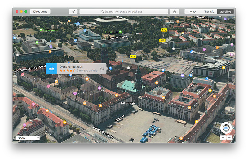
As part of Apple's continued Maps buildout effort, the company on Wednesday added 3D Flyover, traffic and point of interest data to its in-house mapping solution, including popular locales like the Virgin Islands and Taiwan.
In what has become a monthly routine, Apple expanded its running list of supported Flyover cities to include 20 new locations in Europe, Africa, Japan and the U.S. Including today's additions, Apple's 3D Flyover feature is available in 240 areas around the world.
- Adelaide, Australia
- Amiens, France
- Berne, Switzerland
- Bremen, Germany
- Columbus, OH
- Dresden, Germany
- Eindhoven, Netherlands
- Johannesburg, South Africa
- La Rochelle, France
- Louisville, KY
- Middlesbrough, UK
- Nantes, France
- Salzburg, Austria
- South Bend, IN
- Springfield, MO
- Taormina, Italy
- Toulouse, France
- Toyama, Japan
- Tucson, AZ
- Virgin Islands
Apple uses high-resolution photos and sophisticated three-dimensional models to render Maps' Flyover imagery. The feature makes it easy to spot landmarks, buildings and other objects of interest and is marketed as an alternative to Google's ground-level Street View product.
In addition to new Flyover cities, Apple activated live Traffic data for Taiwan. Finland was also added to the list of countries serving up data for iOS 9's Nearby, a feature that suggests close by points of interest based on their proximity.
Offered up in Maps and Siri Suggestions, the service automatically populates a set of predefined search categories, such as Food and Health, with information based on a user's location. Apple first launched Nearby in September with data for six major markets, adding three more in the past few months.
Apple's iOS Feature Availability webpage was most recently updated two weeks ago.
 AppleInsider Staff


-m.jpg)


 William Gallagher
 Malcolm Owen

 Christine McKee
 Chip Loder
 Oliver Haslam


22 Comments
This will be great when I win a Helicopter. lol
If apple was serious about services they would have bought HERE maps with that pile of money they have been sitting on.
You know those vans Apple has been sending around the streets of various cities? I believe they will use them to extend flyover so that you can seamlessly fly all the way down to street level. This would compete with Google's street view.
Wish they'd do Pittsburgh; one of the more picturesque cities in the country, it's just begging to get the 3D treatment.
And still the more prosperous south of England gets ignored, apart from London. Middlesbrough?!? Really?!