Maps in iOS 7 will gain a full screen mode that emphasizes how Apple's 3D Flyover imagery is much easier to navigate, more detailed and significantly more up-to-date than even the desktop 3D offerings of leading map vendors Google and Nokia, let alone their mobile app offerings.
Apple Maps takes iOS from trailing to leading in 3D
At Apple's introduction of iOS 6 last fall, iOS 5 Maps had been serving up bitmapped tiles from Google, which supplied only a flat, 2D representation of the massing of modeled buildings (below left).
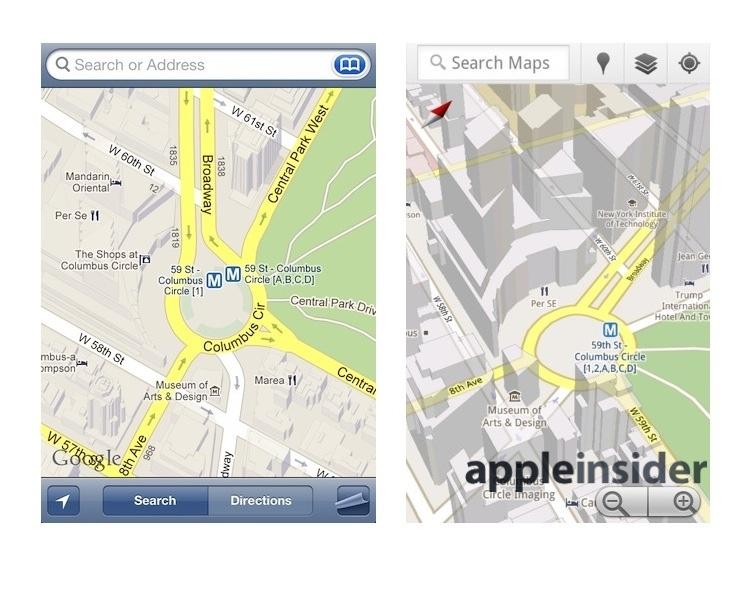
iOS 5 Google Maps vs Android Google Maps
Google's own Maps+Navigation app for Android (above right) presented the same building models with the added ability to freely rotate the map, allowing users to see the shape of landmark towers from multiple angles and discern the accurate relationship of buildings and the roads around them.
Apple 2D & 3D Standard Maps
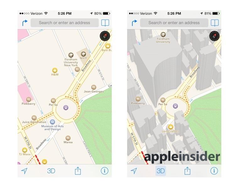
While Apple also added 3D building massing models of its own to iOS Maps in Standard mode (above), it additionally enabled users to take Satellite maps into the modeled 3D perspective mode Apple referred to as Flyover (below).
Apple 2D & 3D Satellite Maps
Flyover gave Apple's new iOS Maps a compelling alternative to the Google Street View feature it was missing (the replication of which would be both a difficultly complicated and expensively inefficient task for Apple to attempt).
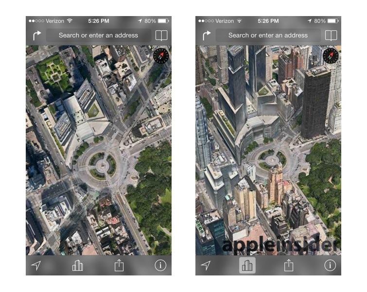
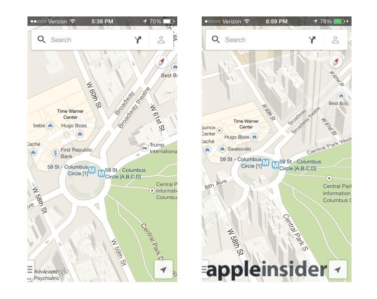
It also helped to make up for Apple Maps' other shortcomings, including having far fewer and often less sophisticated 3D building models (visible above in the Time Warner Center building, opposite Central Park in New York City; the latest Google Maps for iOS don't actually show the building in favor of instead presenting an indoor mall map, another feature Apple doesn't yet match).
Google Maps 2D & 3D Standard Maps
Flyover's alternative representation provides an additional sanity check for users trying to orient themselves on the map, and represents a feature that's still missing from even the new Google Maps for iOS.
When Google Maps' satellite imagery is taken into perspective (above), it simply appears as a flat, confusing distortion of the overhead view.
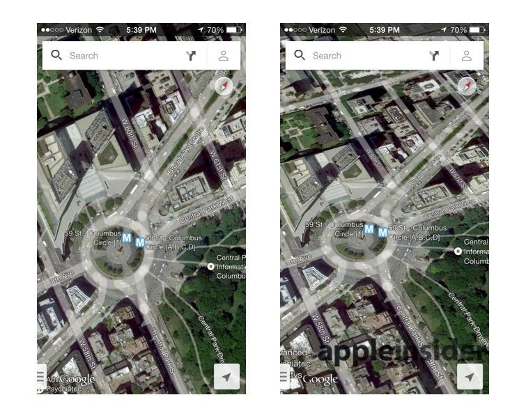
Google Maps 2D & 3D Satellite Maps
To see realistic models, users have to leave Google Maps and launch Google Earth (below right), which lacks the same easy navigation controls and the traffic and directions of an actual mapping app.
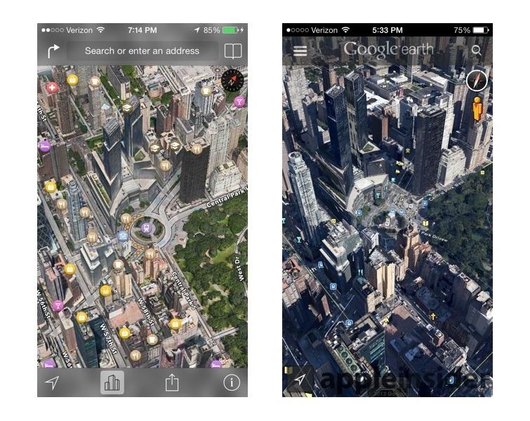
Apple Flyover vs Google Earth
Details in Flyover (above left) appear less sharply distinct in this screen shot, but in actual use it is far easier to position and read than Google Earth, and consumes a lot less memory. Google Earth frequently complains of running out of memory in actual use, and is both plodding and laggy.
The technology behind Apple's high performance photorealistic, interactive 3D Flyover map images originated at C3 Technologies, which Apple acquired in late 2011.
Nokia 3D Maps via C3
C3 had demonstrated its technology at CES 2011 (shown in the video below), eliciting the description of it being a "Google Maps on steroids."
Shortly afterward in April 2011, Nokia released a preview of its work in partnership with C3 to develop 3D Maps imagery for its web-based Ovi Maps, now branded as Nokia HERE.
Nokia stated at that time that C3's 3D mapping "uses modern camera equipment to capture as many as one image per second of the same object from up to 100 different angles. The images are then used to automatically reproduce the shape of the objects with very high accuracy. After that, an image processing software automatically drapes each shape with the texture chosen from the pictures of each object.
"The same process is being applied for all objects – buildings, houses, trees, and hills – the result is a seamless canvas of 3D-data where the resolution (8 to 12 centimeters per pixel) and quality is consistent over the entire model. This is the secret to C3 maps’ realistic look compared to competitors’ hand-made and cartoonish appearance."
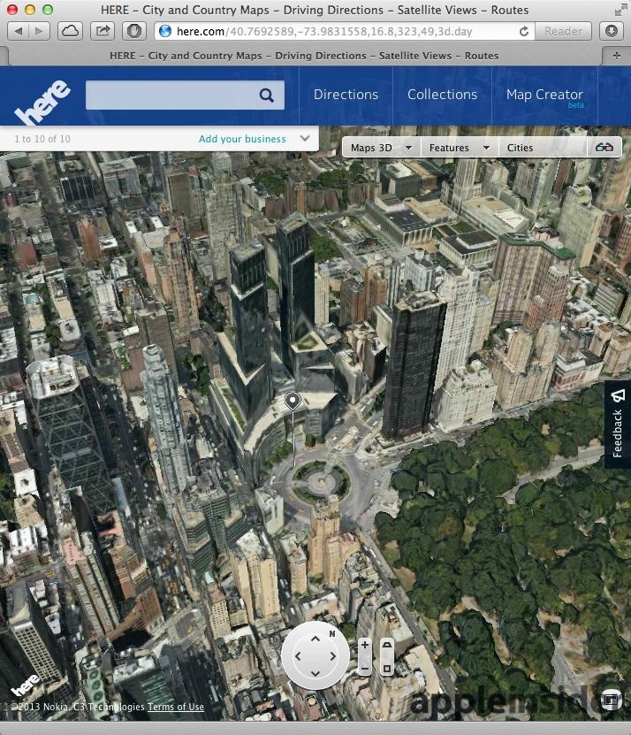
Nokia said C3 had finished mapping parts of 20 different major cities in Europe and North America, promising more to come. However, Apple's acquisition of C3 has left Nokia with 3D imagery limited to just 25 cities, including parts of New York City (below).
Nokia 3D Maps
Even within the limited 3D Maps Nokia offers, imagery appears to be considerably less detailed and often much older than those available through Apple Maps, and is also more difficult to position and navigate (although not as bad as Google Earth).
Nokia's 3D Maps also require a desktop web browser with support for WebGL, so they won't work on iOS devices. Nokia's HERE app for iOS doesn't include support for the company's 3D Maps either.
Dam that's bad
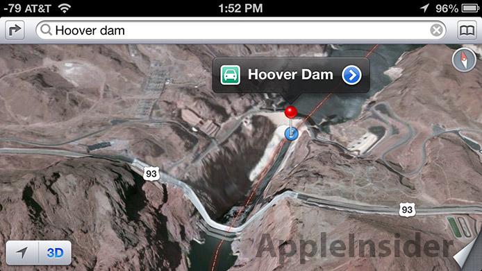
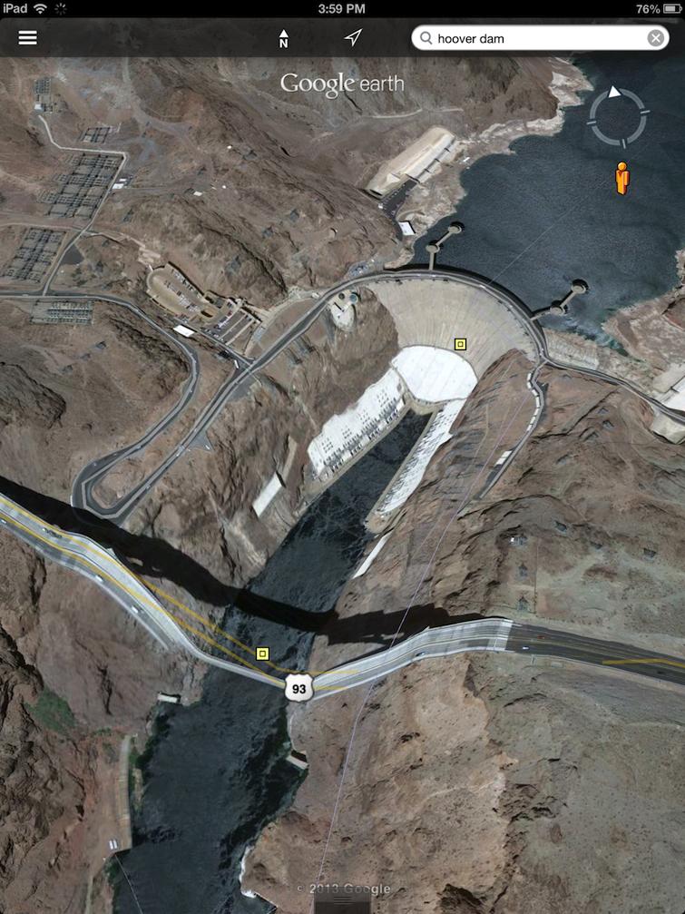
Outside of the select areas where it has 3D Maps, Nokia presents the same sort of unfinished landscape massing that Apple Maps do outside of Flyover supported areas. Apple's Maps were initially criticized, for example, for portraying Hoover Dam within a 3D landscape that didn't correctly render the Highway 93 bridge crossing the valley below it.
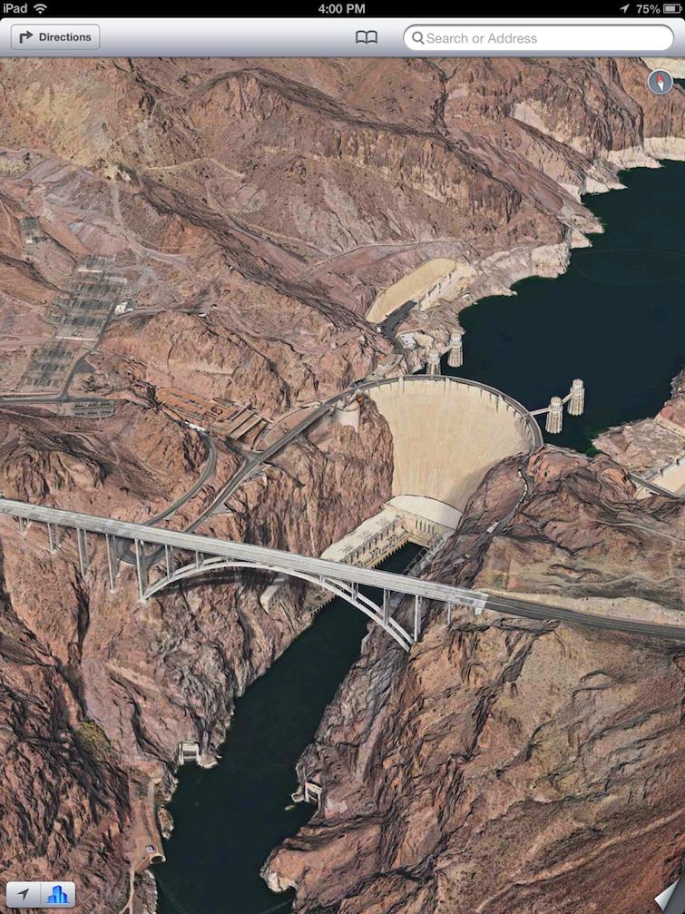
Apple has since greatly expanded and enhanced its coverage in Flyover, as shown in its updated imagery of Hoover Dam, below.
Nokia's 3D Maps continue to render the landmark so poorly that it's hard to even tell its a dam.
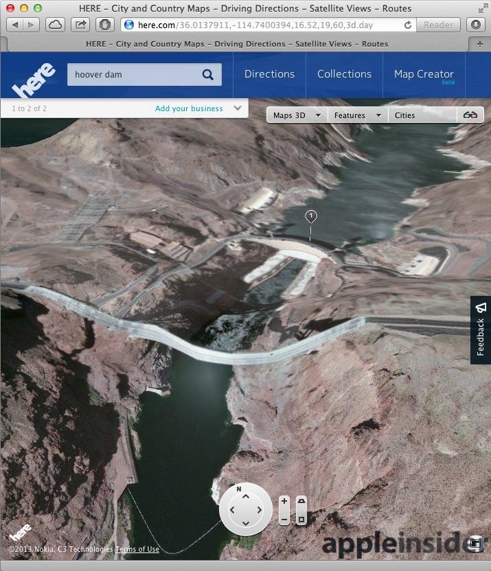
Source: Nokia HERE
Google Earth's portrayal of the landmark is similarly bad (below); it continues to show the same sagging highway that Apple's critics had poked fun at a year ago. That's noteworthy because Google Earth had been released seven years earlier, and regularly updated since. A year later, it still isn't accurate.
Google Earth via Keyhole, SketchUp
Google originally introduced Google Earth in 2005, the result of the company's 2004 acquisition of Keyhole, a project that had been funded by the U.S. Central Intelligence Agency. Google initially launched Earth as an interactive globe-browsing app for Macs and PCs in a limited free version, a now-discontinued paid Plus version and a $399 Pro edition intended for commercial use.
In 2006, Google acquired the 3D modeling software SketchUp, using the product to allow anyone to create building massing models that could be submitted to Google in order to rapidly populate the Google Earth landscape with interactive, 3D visualizations of cities, building data Google eventually incorporated into Google Maps. SketchUp eventually allowed users to skin 3D models with actual photos, resulting in realistic 3D imagery for Google Earth.
After Apple unveiled and then launched its own new Maps for iOS 6 with 3D Flyover last fall, Google spent the rest of the year quickly porting its Android Google Maps+Navigation app to iOS for a December release.
In 2008, Google Earth and its 3D models of buildings were brought to the web via a plugin, and in 2009 the company released a native Google Earth app for iOS. However, after details began to leak about Apple's plans for C3, Google lost interest in SketchUp and announced plans to sell the software to a third party in April 2012.
After Apple unveiled and then launched its own new Maps for iOS 6 with 3D Flyover last fall, Google spent the rest of the year quickly porting its Android Google Maps+Navigation app to iOS for a December release.
To present 3D visualizations, the app launches the company's separate Google Earth app. However, like Nokia's 3D Maps, Google Earth visualizations are lower quality and based on older images than Apple's Flyover.
This year, Google also released a new beta of a separate, browser-based version of Google Maps with 3D imagery that draws from Google Earth but present it using greatly improved navigation. Like Nokia 3D Maps, Google's browser-based 3D Maps uses WebGL, so it isn't supported on iOS, or even officially on Safari (although it does work in Safari if forced).
The new Google Maps and its Earth-derived 3D views improve upon the frustrating navigation controls and other limitations of Google Earth, but it's also limited to views in just four directions, making it impossible to fluidly pan the map to the same angle we used to capture Time Warner Center in other apps.
Google Street View vs Apple Flyover
While some users have scoffed at Flyover being a suitable replacement for Street View, Google's rapid response to integrate its own Earth-based alternative to Apple's 3D imagery within its own Google Maps app indicates that the search giant is taking Apple's encroachment upon its once-uncontested mapping services quite seriously.
Apple supports a rather astonishing level of detail in Flyover, and augments its closeup 3D imagery with Yelp's user submitted photos, often yielding useful indoor and exterior pictures for many points of interest.
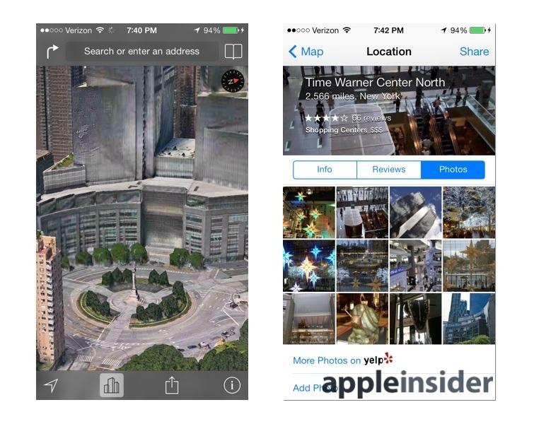
Apple Maps Flyover closeup & Yelp photos
When asked for a Street View of Time Warner Center, Google Maps zoomed into this image obliterated by a bus, illustrating the hazards of automated image collection from Google's Street View camera-equipped cars (visible in the photo).

Google Street View #Selfie
Navigating to the right, the images kept following the bus, before jumping up onto a platform and peering into this open door, where something private appeared to be going on.
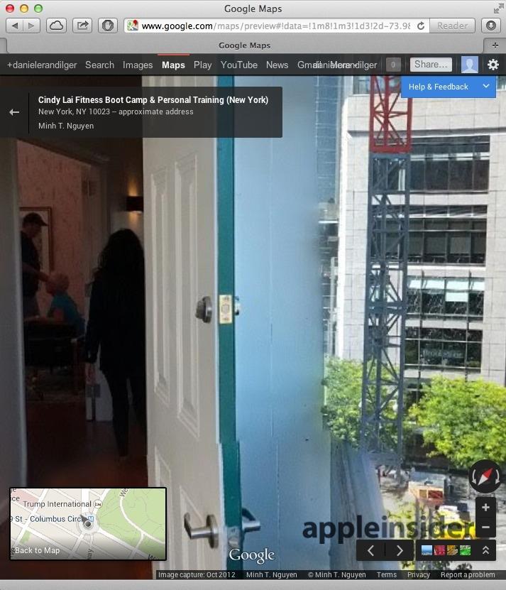
Google Open Door View
While it's certainly not impossible to find useful Street View images (below), navigating through Google's shots often takes time and is generally limited to vantage points available to car. Trying to approximate the same view of the Circle with the Center behind it that Flyover quickly presented was complicated by the traffic logistics of Columbus Circle itself.
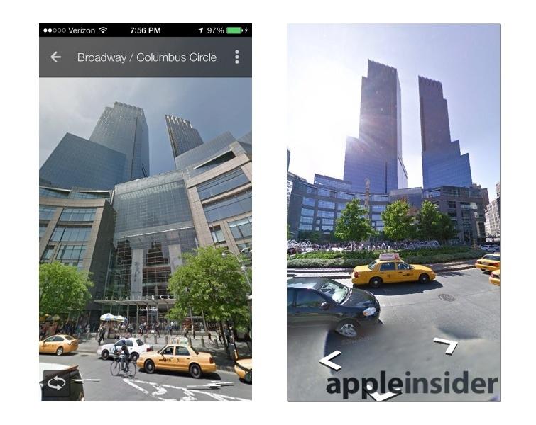
Google Maps iOS app Street View
Carbon dating the 3D Maps of Google and Nokia
While Google is sitting on years of accumulated landscape and building data related to Google Earth, its existing 3D product is hampered by constraints that include very limited viewing angles and clumsy navigation controls. Google Earth is simply frustrating to use with multitouch gestures.
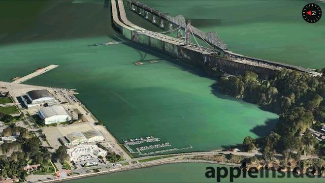
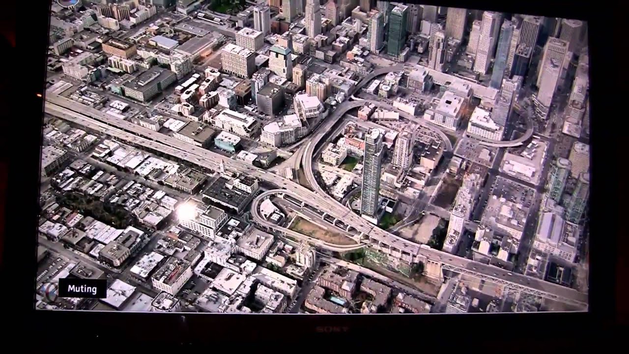
Its imagery is also dated and less detailed than Apple's more modern Flyover visualizations. Note the difference (below) between Apple's current iOS 6 Maps on iPad; Google Earth on iPad; and experimental Maps 3D running in a desktop browser by Google and Nokia, each looking over the corner of Treasure Island toward the construction of San Francisco's replacement Eastern Span of the Bay Bridge.
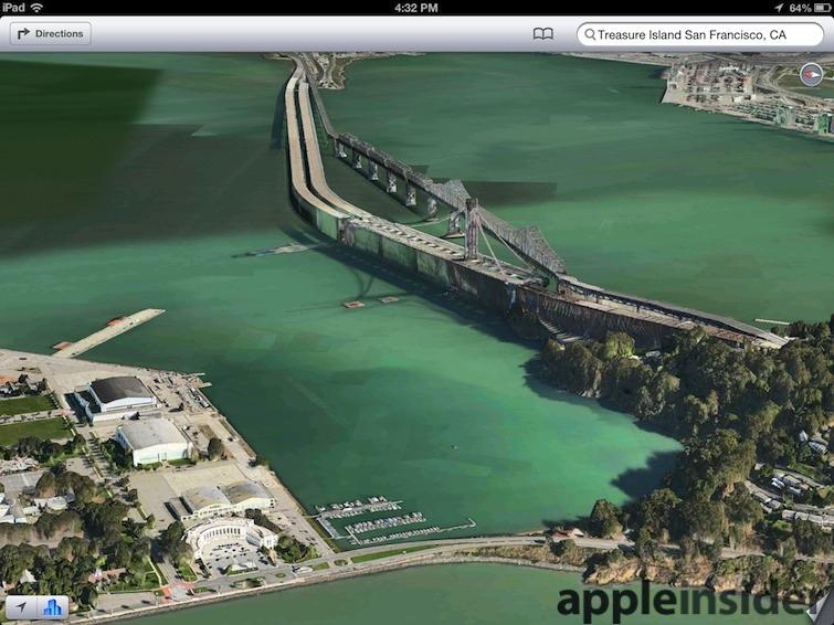
iOS 6 Maps
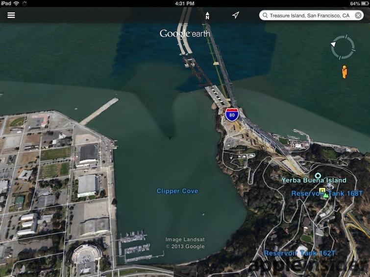
Google Earth
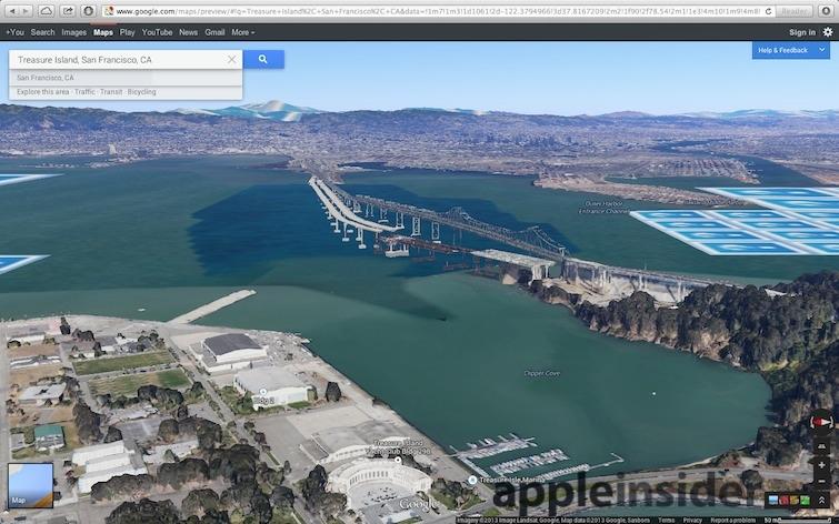
Google Maps beta with Earth
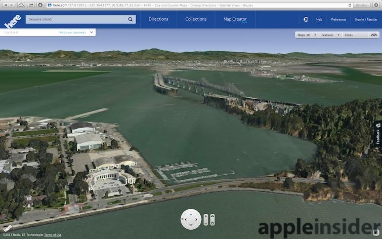
Nokia 3D Maps
The various images track the glacial pace of the Bay Bridge, now under construction. Incredibly, the project began in 2002 and is still not yet finished. Work on the tower, which only appears in Apple Maps, began in 2010. This indicates that Nokia's images date from around 2008, while Google's are from around 2009. Apple's appear to be at least as recent as late 2011, when compared to independent construction progress images.
Each product supports a different range of viewing angles; Google Earth is particularly limited in how close to the horizon you can view. It also lacks 3D perspective for the buildings on Treasure Island in the foreground.
However, due to a combination of low user expectations, sufficient "beta" warnings and much more forgiving media coverage, the public is largely unaware that the Flyover Maps that Apple deployed to millions of users last year in iOS 6 are simply much better than what Google and Nokia are showing in limited browser-based beta environments today.
Apple Maps headed to the desktop in OS X Mavericks
The upcoming release of OS X Mavericks this fall will bring Apple's Maps to the Mac desktop in the form of a native app, giving it an enormous advantage over the web-only mapping services offered by Google, Nokia and others.
As a native Cocoa app, OS X Maverick Maps is blazing fast, supports familiar multitouch trackpad gestures like pinch to zoom, directly integrates with Contacts, syncs location Bookmarks with iCloud and can share locations and directions using standard Share Sheets via email, iMessage, nearby users with AirDrop or to Twitter and Facebook.
One of the primary notable features in OS X's new Maps app, as demonstrated by Apple's head of software engineering Craig Federighi at WWDC last month, is the ability to plan a trip at home and then forward the route, via iCloud, directly to your iPhone for turn by turn directions in your car (below).
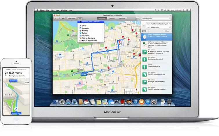
Source: Apple
Google pioneered a similar feature that allows Google Maps to forward directions or locations to a car's GPS starting back in 2007, which included support for navigation systems from Audi, BMW, Ford Sync, Mercedes-Benz, OnStar and GPS units from Garmin and TomTom.
However, the company now says that Google Maps no longer supports the option of sending maps or directions to a phone (likely because it didn't want to subsidize SMS fees; Apple will use free iMessage-style push notifications).
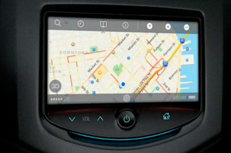
Apple also plans to integrate its maps directly into automobiles via iOS in the Car next year.
Apple also has plans to add other new features to iOS 7 Maps, including night mode and new integration with Apple Data Detectors.