Apple is reportedly improving the detail of its train/subway station mapping for Tokyo and other Japanese cities, preparing for the long-awaited arrival of public transit directions.
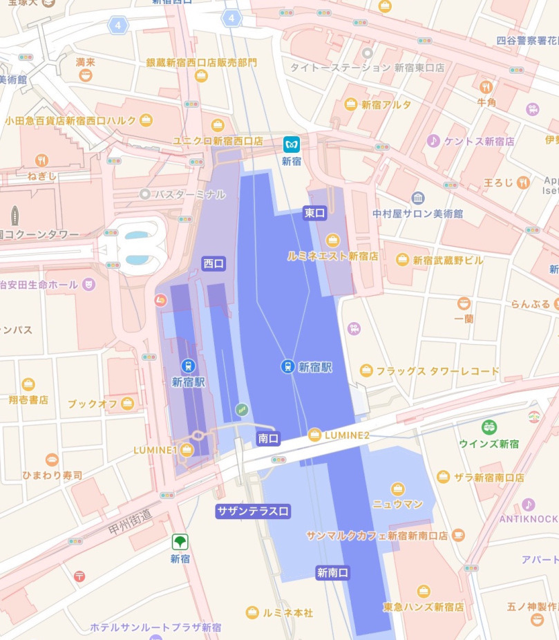
Apple's Maps apps for iOS and Mac now show the platforms at major Tokyo stations (like Shinjuku) in dark blue, with surrounding buildings — in light blue — rendered more accurately, Ata Distance noted on Thursday. Testers of the iOS 10 and macOS Sierra betas should also see indoor mapping in some cases, although exit information may be lacking.
Other cities with better data include Osaka and Nagoya, though again, only at major stations.
A source for Ata Distance claimed that Apple is handling all of the indoor mapping itself, since it doesn't have a third-party data provider to turn to.
In July Apple confirmed plans to add Japanese transit data with the launch of iOS 10, but otherwise said little. Theoretically support might begin with Tokyo and expand outwards, but the company might also adopt a China-like strategy and add several cities at once.