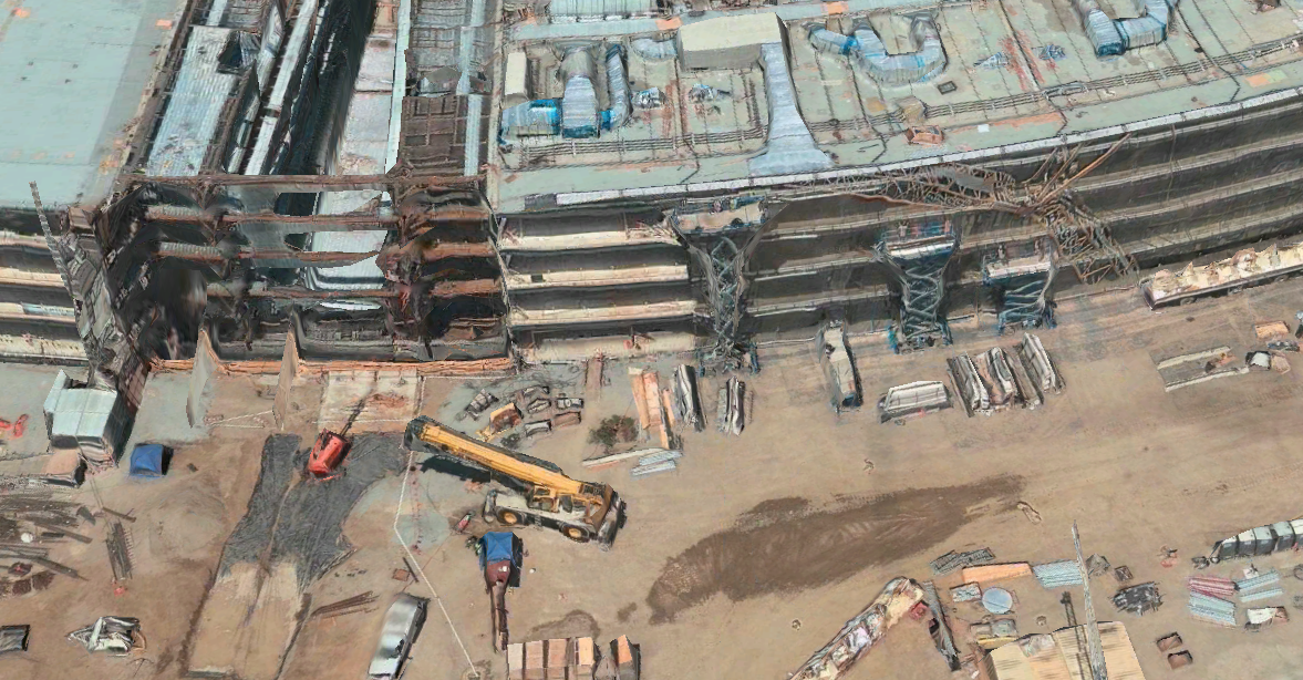
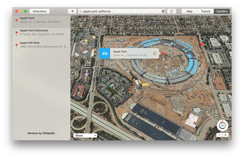
Apple in a recent update to its Apple Maps service added satellite and drone imagery, as well as related geolocation tags, covering Apple Park, the company's headquarters that is currently under construction in Cupertino, Calif.
As seen in the screenshot above, Apple Maps now includes image assets and informational POI tags for Apple Park. The additions come just two weeks before Apple employees are scheduled to begin moving into the new campus in early April.
While the mapping service contains both satellite imagery and high-resolution photographs for 3D Flyover views, the assets appear to date back about seven months. Of note, Flyover pictures of the circular "spaceship" structure shows sections of roof with bare HVAC systems, while other portions are covered with newly installed solar panels.
Additionally, the main office building's interior area is full of heavy equipment, roof panels being readied for installation and bare dirt. The courtyard shows no signs of landscaping, an effort that began in October.
Drone video shot in July to August of last year appear to depict roughly the same state of construction progress as seen in Apple Maps.
The new Maps assets, spotted by 9to5Mac on Wednesday, also include destination information, a physical address and building tags, including a data tag for Steve Jobs Theater. As it does for other points of interest, Apple Maps aggregates photos and general information about Apple Park from the internet, in this case user-submitted photos from Wikipedia.
Apple officially assigned the name Apple Park to its second Cupertino campus last month, saying at the time it expects more than 12,000 workers to start making the migration from its current headquarters in April. The move is estimated to take over six months to complete.
Designed in collaboration with architectural firm Foster + Partners, Apple Park replaces 5 million square feet of asphalt and concrete with grass, local vegetation and intelligently designed buildings powered by sustainable energy sources. Construction is far from finished, but once the job is done, employees will be able to take advantage of walking and running paths in a parklands area, as well as an orchard, meadow and pond located within the ring's interior.
 AppleInsider Staff





-m.jpg)


 Chip Loder
 Mike Wuerthele
 Malcolm Owen


 Amber Neely
 William Gallagher



-m.jpg)


7 Comments
1) Interesting that they would've done this when it was still so far from completion.

2) It's interesting that so many of the images have excessive artifacts that I would've thought they'd want to clean up since they know this will get a lot of eyes on it. Here's the R&D building as an example:
3) It's interesting that FlyOver allowed me to notice new stuff while at the same time being considerably worse image quality.
4) I noticed the R&D building does have underground parking, too. I also noticed there's a waterway between it. I wonder if they have to take the road around to an entrance of if there will be a bridge over the skywalk since the main parking garage and theatre are across it. I'm guess no, which is why R&D was put there with a little more isolation.
5) I looked for the damn barn across the entirety of Apple Park and just outside it but nothing stuck out.
From this video, I can pretty much tell the R&D building will be what employees move into next month. The interior of the main building doesn't appear to be anywhere near finished. That looks to be a few months out yet. However, its large building and we can't see every single part of the interior so I could be wrong. Here is the video that was recently posted...a Mid-March update: https://www.youtube.com/watch?v=mmdnDDSP83E
I wonder what kind of aircraft they are using to get flyover data. And why it takes so long to add new cities. And when their street view (what I like to call Drive By) wil be ready. They simply have to be working on something.
Here's another one from the set of Hunger Games. I tried google maps and their street view only showed fences so I have nothing to compare Apple' flyover to. Creating the 3D version has to be difficult with a tremendous amount of computations.
