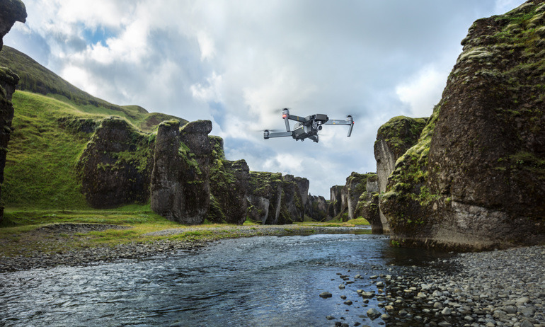
Apple is reportedly one of a number of major corporations hoping to participate in a range of drone tests beyond those normally allowed by the U.S. Federal Aviation Administration, an initiative the company hopes will lead to better Apple Maps images.
An impending pilot program will involve night flights, flying over crowds, and going beyond an operator's line of sight, Reuters reported. Sources told the agency that Apple, Airbus, Amazon, Intel, and Qualcomm are among 200 or more companies wanting to join.
Apple is looking to improve Apple Maps, likely through high-resolution images captured for the app's Flyover feature. As usual, the company is operating the project with an eye on privacy, saying it will blur sensitive subjects like faces and license plate numbers.
Later on Wednesday the U.S. Transportation Department is due to announce 10 winning local governments for the tests. Candidates have partnered with various businesses, with Apple linked to North Carolina.
Senator Dean Heller of Nevada has claimed that Reno is one of the winning governments, working in tandem with Flirtey, a firm developing drone delivery of defibrillators and Domino's pizza.
A U.S. official told Reuters that other winning projects are tackling areas like agriculture, package delivery, drone flights near airports, and pipeline and environmental monitoring.
While Apple isn't normally associated with drones apart from selling ones by companies like DJI, the company has likely been using them for some time, reportedly to rapidly update Apple Maps data. It also has a fleet of Google-style minivans for reconnaissance, but these operate far slower.
Conceivably Apple could also want to monitor facilities, deliver packages, or even develop its own drones, but there have been no rumors to that effect. The company's main interest in autonomous vehicles is thought to be its self-driving car platform — and even then its goal is believed to be partnership with one or more ridehailing firms, rather than an "Apple Car."
Update: Updated with state affiliation information and expected deployment details.
 Roger Fingas
 Oliver Haslam
 Thomas Sibilly
 Marko Zivkovic
 Wesley Hilliard
 Malcolm Owen
 Andrew Orr


-m.jpg)


14 Comments
The self driving car folks are very intelligent but their pattern indicates 2-dimensional thinking.
Mr. Ive --- Z+10,000 meters!
Whomever wishes to provide the best smartphone camera must consider drones.
 .
.
I envision a future where you arrive at an adventure destination, like Volcano Island in Lake Taal, Tagaytay, Philippines (where I was hiking last week). You jump on your iPhone and request a drone to video your hike. The drone is dispatched from a nearby vendor location (not unlike vendors who rent scooters or jetskis) and it flies autonomously to your location, communicating constantly in the background with your phone. An app lets you choose a number of video options for how the drone will capture your hike. Then you just go hiking. After you’re done the drone service provides you your video via the cloud, completely mixed with a soundtrack of your choosing. Plus the raw footage If you want to do your own edited version. You never have to fly the drone, carry it, charge it, etc. The right drone with the right capabilities and power capacity is provided based on the experience you’re undertaking. If I’m Apple I’d envision such applications and want to have a hand in delivering that future.
When space trash wasn’t enough... now we have sky trash.
My guess is that Apple has extensive R and D in the drone sphere already, and is poised to blow it up with innovation.
I look forward to shooting a drone out of the sky to get a free pizza.