Apple is making Apple Maps more accessible to pedestrians in the UK, by sending out workers wearing data-collecting backpacks to go where its fleet of mapping cars cannot reach.
Mapping services like Apple Maps typically rely on data collected from a modified vehicle traveling along roads, but the approach means pedestrianized areas sometimes get left out. In the UK, Apple is working to improve Apple Maps for pedestrians, by collecting more data away from the cars.
Starting from Monday and continuing through until May, Apple is sending out employees in areas of London, Birmingham, and Manchester to collect more data for Apple Maps, reports Bloomberg. The effort will focus on areas where cars cannot easily access an area, but pedestrians have free rein to walk through.
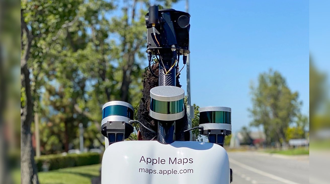
The employees will carry backpacks that contain an array of sensors and imaging devices, similar to what is placed on Apple Maps cars. The backpacks will help create 2D maps of the areas, as well as to enhance the Look Around feature, giving users more places to view from their devices.
Parks, city squares, and transit stations are said to be targets of the team, with Birmingham's Bullring, New Street, and Edgbaston Street on the list. In Manchester, areas for mapping include Albert Square, Shambles Square, and St. Peter's Square.
On its Image Collection page, listings indicate Apple will also be collecting data via backpack in Berkshire and Staffordshire.
"Apple is conducting ground surveys with vehicles around the world to collect data to improve Apple Maps and to support the Look Around feature," the company explained. The updates will use "the same privacy protections as the Apple Maps vehicles," which will include censoring of faces and license plates that appear in Look Around.
Apple started to use pedestrian-based data collection for Apple Maps in 2018, using a heavily customized backpack in San Francisco.
This is also not the first time that Apple has used its pedestrian teams in the UK. In 2020, a similar effort was made, complete with cameras and LiDAR sensors on the backpacks,with London also included in its coverage.
 Malcolm Owen


-xl-m.jpg)


-m.jpg)


 Christine McKee
 Amber Neely
 William Gallagher


 Mike Wuerthele






3 Comments
A few months ago Apple added flyover maps to one of the UK's largest cities not far from me. Only took them 9 years.