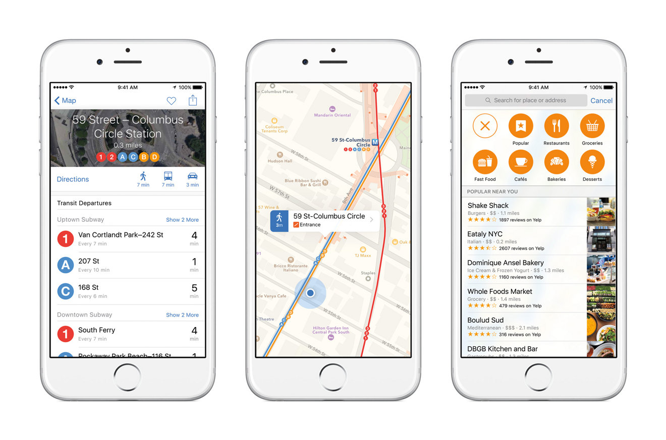
As expected, Apple announced transit directions integration are coming to the Maps app in iOS 9, featuring multi-modal routing, rail line information and Siri integration, among other functions.
Fittingly dubbed Transit, Apple's transit solution brings public transportation options into Maps, including data for buses, subways and ferries.
Unique to Transit is deep train station mapping that depicts underground structures in their entirety instead of as a dot. Also supported are walking times from one end of a subway station to another, providing more accurate estimates to help commuters catch their train.
Transit also features support for Siri, meaning Apple's virtual assistant will be able to incorporate transit options alongside vehicle and walking directions.
At launch, Transit data will be available in Baltimore, Berlin, Chicago, London, Mexico City, New York City, Philadelphia, San Francisco, Toronto, and Washington, D.C. Apple highlighted Chinese availability with initial support in Beijing, Chengdu, Guangzhou, Hangzhou, Shanghai, Shenzhen, Wuhan, Xi'an and Zhenghou, with more to come.
 AppleInsider Staff


 Wesley Hilliard
 Malcolm Owen

 William Gallagher


20 Comments
[quote name="sog35" url="/t/186634/apple-unveils-transit-data-for-maps-in-ios-9#post_2732435"]i wish this was available last week when i was in NYC [/quote] Did you lunch with [@]Apple ][[/@]? :lol: How many stores did you visit? The one in Grand Central Terminal is quite unique, but I normally go to the SoHo store.
i wish this was available last week when i was in NYC
Android has had it for a few years now...lol /s
Visit CrazyUDID, get the brand new iOS 9 Beta and win an Apple Watch! Fast and reliable service!
[quote name="fallenjt" url="/t/186634/apple-unveils-transit-data-for-maps-in-ios-9#post_2732469"][QUOTE name="sog35" url="/t/186634/apple-unveils-transit-data-for-maps-in-ios-9#post_2732435"] i wish this was available last week when i was in NYC [/QUOTE] Android has had it for a few years now...lol /s [/quote] I would've recommended Embark. My 9 yr old son is a subway savant because of it. :lol:
Visit CrazyUDID, get the brand new iOS 9 Beta and win an Apple Watch! Fast and reliable service!