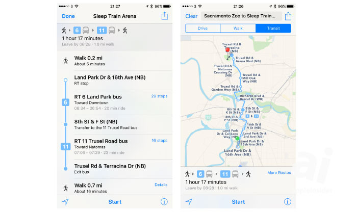
Sacramentans and visitors to Sactown alike can now ride the rails — or the bus — with complete navigational confidence, as Apple has brought Sacramento Regional Transit integration to Apple Maps.
Available conveyances include Sacramento's wide-reaching bus network as well as the city's light rail service. The now-hilariously-named Yolobus, which serves Sacramento International Airport, is also included.
Apple has been slowly but steadily expanding the reach of its transit routing network. Last month alone, the company added support for Portland, Oregon; Montreal, Canada; and Rio de Janeiro, Brazil.
Meanwhile, many major international cities — including public transit standard bearers like Tokyo, Hong Kong, and Seoul — remain unserved. It's not clear exactly why Apple is taking so long to extend coverage around the world, but at least some news on the topic is likely to arrive at next month's Worldwide Developers Conference.
There, Apple is expected to unveil iOS 10 and will almost certainly touch on the next generation of its in-house mapping service. The company has been spotted operating its fleet of data-collecting mapping vans around the clock, and may even announce a new Street View-like offering at the show.