iPhoto for iOS links weather, location info to photos but doesn't use Google maps [u]
 Daniel Eran Dilger
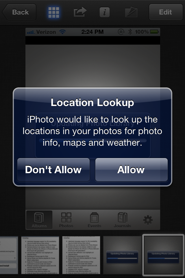
Last updated
Apple has supported geotagging the location of photos taken by iOS devices for some time, but the new interface appears to indicate that photo apps will now be able to associate current weather conditions with a photo when it is taken.
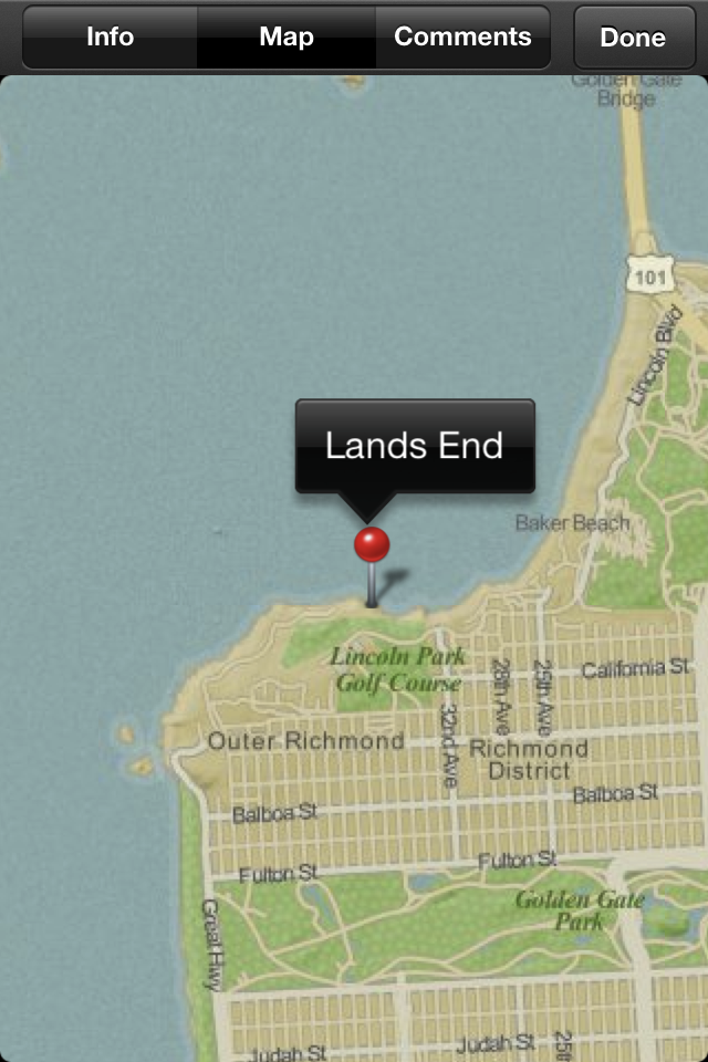
The new iPhoto app works like a souped up version of the bundled Photos app, which already allows users to locate where a photo was taken, placing it on the map using maps from Google.
iPhoto presents a fancier, animated interface with stronger editing features, including the ability to copy adjustments made to one image and paste them to another.
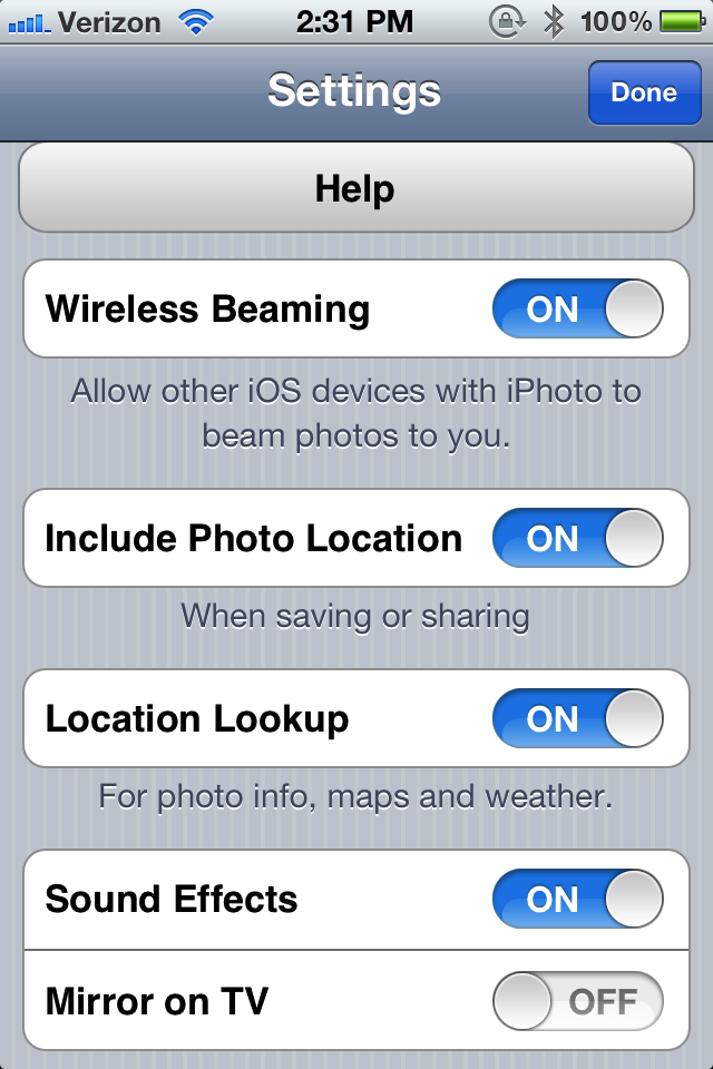
iPhoto now offers to turn off including photo location on images when saving or sharing, and also allows users to turn off location lookup, which it notes is "for photo info, maps and weather." When initially accessing photos, the app asks permission to use the location-based information tagged on them.
Also of note is the fact that Apple's new iPhoto doesn't use Google Maps to pinpoint the location of photos anymore. Instead, it uses a different style of map that isn't credited to anyone, suggesting that Apple is releasing the first of its own internal mapping services. The new maps also provide less zoom control and detail.

The company has acquired a number of mapping services, and has long been expected to move to its own mapping system to avoid its dependance upon Google, a move that appeared to intensify after Google began competing with Apple using Android software.
Last fall, Google said it would begin charging major partners who serve up more than 25,000 uses per day of the Google Maps application programming interface service, starting this year. Apple's scaled down maps may be intended to use a cheaper or alternative version of the maps Google serves.
John Gruber stated that Apple representatives told him that the company was still using Google data for mapping in the new iOS iPhoto app.


 Amber Neely
 Thomas Sibilly
 AppleInsider Staff
 William Gallagher
 Malcolm Owen
 Christine McKee


12 Comments
In other news, The Estate of Gene Roddenberry and all Trekkers are the latest to sue Apple. Documents filed in United States District Court for the Eastern District of Texas reveal the dispute is over the use of the term Wireless Beaming on a portable communications device.
So does this library live by itself on an iOS device or can the photos be merged into a Mac iPhoto library or what?
Anyone know if it supports keyword tagging? I always thought there were great opportunities for tagging on a tablet.
The quality of that map looks pretty bad
So does this library live by itself on an iOS device or can the photos be merged into a Mac iPhoto library or what?
Anyone know if it supports keyword tagging? I always thought there were great opportunities for tagging on a tablet.
Great questions to ask @ WWDC 2012.
Apple rolling their own mapping solution to reduce dependence on third-parties? Very awesome.
Using highly compressed JPEGs instead of vector formats? Very very very not awesome.