Apple's iOS 6 3D Flyovers aim to be more helpful, less creepy than Google Street View
 Daniel Eran Dilger
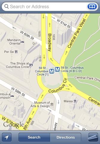
Last updated
Apple's strategy of taking its Maps solo in iOS 6 was described in Apple wants to wipe Google off the map with iOS 6, while a second segment, How Apple's new vector-based Maps leave Google Maps looking jittery detailed how the company will be levering vector graphics to greatly improve the Maps experience in iOS.
However, there are a variety of attractive features Google has bundled into its web and app-based Google Maps portfolio, providing a tall order for anyone hoping to replicate all those features. Apple certainly has big shoes to fill in the maps department. Among these are:
Google's 3D models and StreetView maps
Google Earth began mapping the world with 3D building outlines, a feature Google later brought into the Android version of its mobile maps client. Apple never adopted these 3D models however, so all iOS users see in the current iOS 5 Maps client is a 2D depiction of the building outlines Google has added to the bit mapped tiles it serves Apple's Maps client, without any ability to freely rotate the map (below, in contrast with Google's 3D massing models visible in Google Maps for Android).
More recently, Google has introduced 3D features that essentially paint images from aerial photography onto building outlines, resulting in a nearly photorealistic 3D model that users can explore from different angles. These features require significant client-side processing power to render, and just as with Google's basic 3D outlines, Apple hasn't ever incorporated them into its iOS Maps client.
In order to provide an explorable map that is efficient in both processing and bandwidth requirements (compared to 3D model rendering), Google first began its StreetView project, which sends out vehicles to all major roads, taking panoramic images that users can then access in a "you are there" view of virtually any block face visible from virtually any significant road Google's camera-equipped cars have traveled.
Conceptually, StreetView can be dated back to an ARPA project developed at MIT, which in 1978 began mapping the town of Aspen, Colorado, using photographs stored on interactive Laserdisc, allowing users to virtually walk down streets, and even bring up seasonal views of the town from multiple perspectives.
The Aspen Movie Map was one of the first advanced examples of hypermedia, and was described by a young Steve Jobs in a 1983 speech describing the future potential of personal computing.
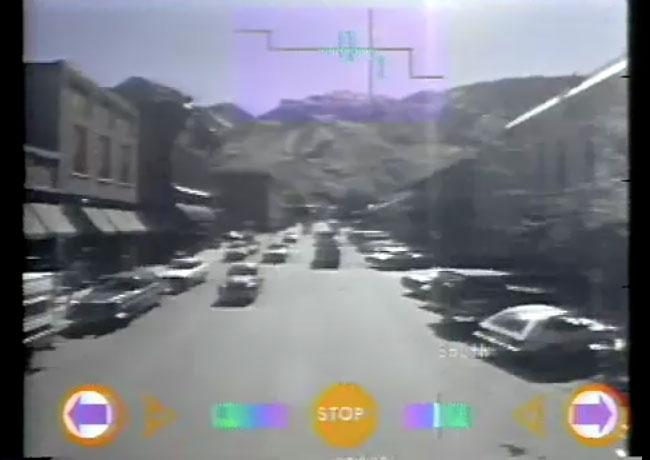
"It's really amazing," Jobs said, describing the project in contrast with conventional, static forms of old media. "It's not incredibly useful," he added as the audience laughed, "but it points to some of the interactive nature of this new medium which is just starting to break out from movies, and will take another five to ten years to evolve."
Ten years later in 1994, Apple would release QuickTime VR, which allowed photographers to stitch together photos taken from a single location into a node that viewers could later explore dynamically, creating a new type of movie where playback was no longer fixed along a linear progression. Users could also jump between nodes, effectively exploring a virtual model of a real or imagined universe one spot at a time (or, alternatively, view an object from multiple perspectives).
QuickTime VR finds a use, 13 years later, in StreetView
While a variety of companies copied or extended upon Apple's work on QuickTime VR, there was never a huge market for the technology. That is, until Google realized that panoramic photography would make an ideal way to efficiently allow Google Maps users to explore the world right from their web browser.
Thus, Google's StreetView exploited a useful application for the QuickTime VR technology Apple pioneered commercially in 1994, four years before Google was founded as a company and 13 years before Google debuted StreetView in 2007.
While not without controversy from privacy advocates (and with government stopping Google's work of StreetView mapping the world in countries like Australia, Germany and India), Google has effectively covered vast areas of Europe, Russia, North America, Brazil, Japan, Thailand, South Korea and South Africa with its camera cars.
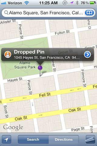
Apple incorporated support for StreetView in iOS 2.2 Maps in 2008, but accessing the feature is not necessarily obvious; users must drop a location pin, bring up its information panel and then tap the StreetView icon to view a local panorama image of the spot (if its is available, and not obscured by passing vehicles or other obstructions).
Users can then step along the street in increments, turn down other mapped streets, and get close enough to houses to see right in homeowners' windows.
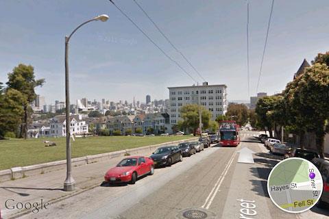
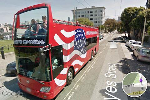


On the web, Google still relies upon the Adobe Flash plugin to view StreetView panoramas, making them inaccessible to iOS users outside of Apple's specially designed Maps client. In iOS 6, Apple has removed the ability to access Google's StreetView images.
Duplicating Google's four years' worth of efforts in mapping streets from the ground level would be an enormous task (although other mapping companies have started doing this). But instead of skating to where the puck was in 2007, Apple has started promoting a new, overlapping feature for Maps in iOS 6: Flyover.
On page 2 of 3: Flyover's virtual StreetView
In August 2011, Apple bought C3 Technologies, known for its work in developing 3D images based on aerial or satellite images. By melding building model outlines with photos taken from satellites or low flying aircraft, C3 figured out how to create virtual models without necessarily sending cameras down the street.
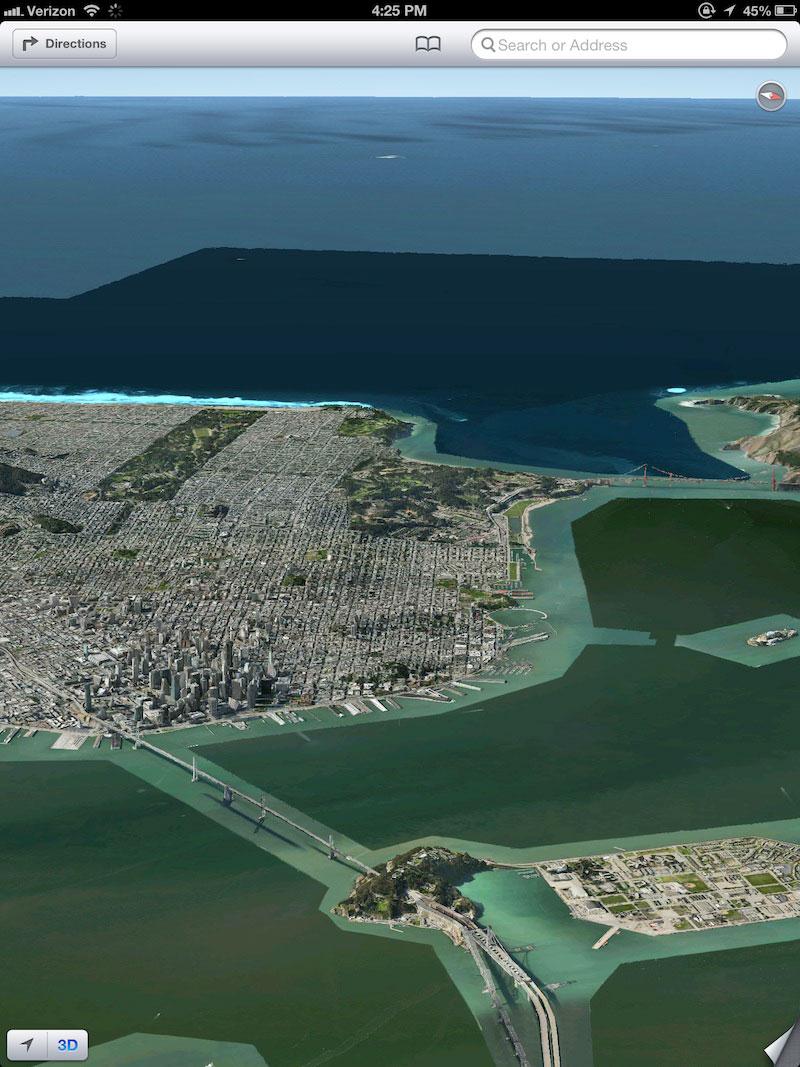
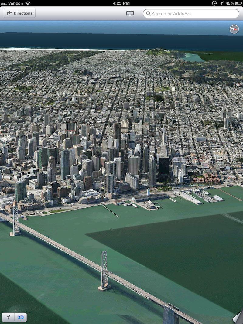
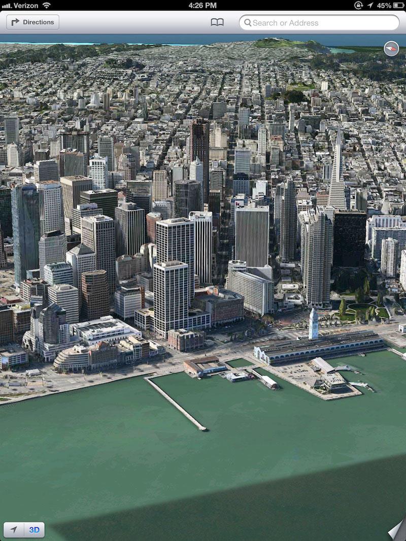
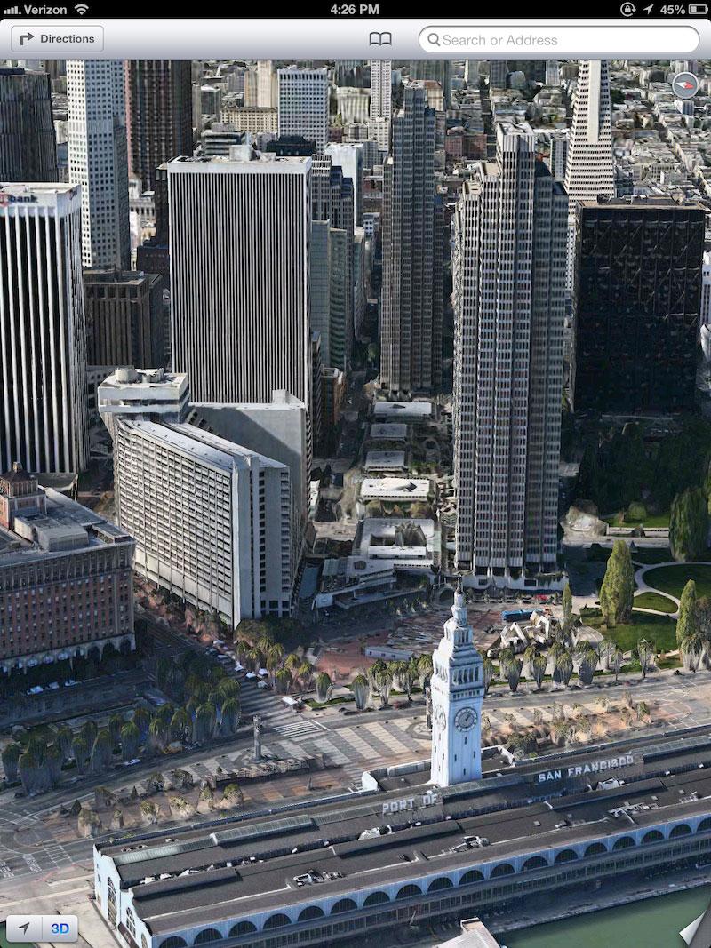
While StreetView is tailored to discovering what an exact address looks like from the perspective of a passing car, Apple's Flyover technology can provide both a bird's eye view of building faces and an interactive, 360 view of panoramas from rooftops or hilltops or virtually any arbitrary, midair vantage point.
Another distinct advantage of Flyover over StreetView is that in StreetView, the user must proceed through panoramic nodes one step at a time. With Flyover, users can hover above a location, viewing the entire street and surrounding streets all at the same time, seeing a continuous representation of an entire path through a given neighborhood.
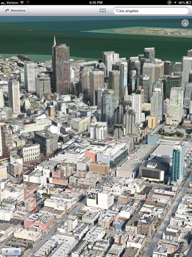
This continuous pan and zoom navigation is more akin to the approach of Google Earth rather than the "one step at a time" StreetView, but Flyover (below top) is distinctly sharper than Google Earth (below bottom) without going so far as offering a view into people's windows.
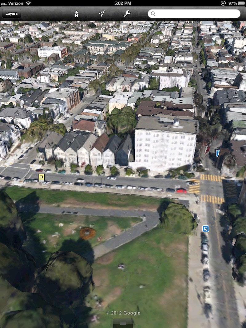
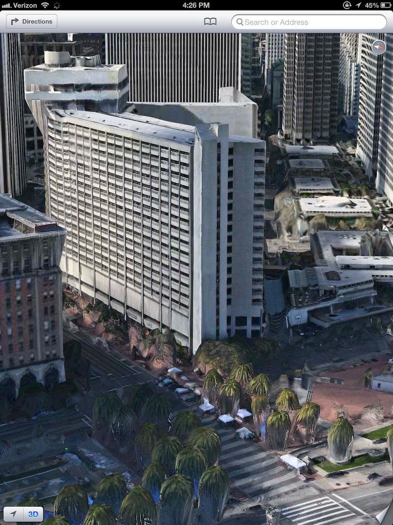
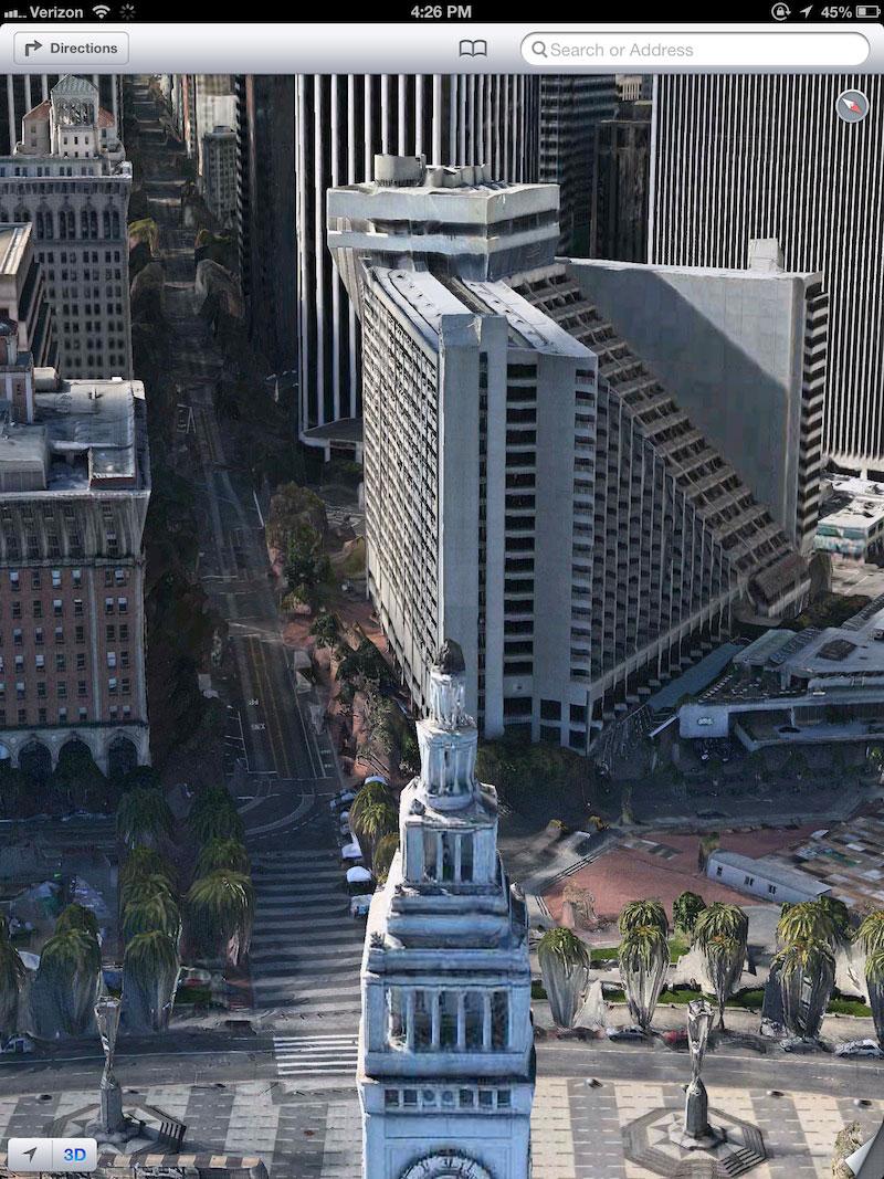
One downside to the Flyover/Google Earth approach is that it is far more computationally intensive; rather than looking at a relatively simple, distorted and stitched photograph of a fixed panorama, the system must model thousands of 3D objects (buildings, tree and other structures) within a given scene, then wrap them with photographic skins.
Every 3D scene is dynamically active, meaning it can be rotated around 360 degrees, up and down, and at a wide range of viewing angles relative to the horizon in a vast 3D space. This provides a modeled city view reminiscent of video games such as "InFamous" (or "SimCity," if you were born before 1985), except with far more detailed complexity and a viewing area a big as the world itself.
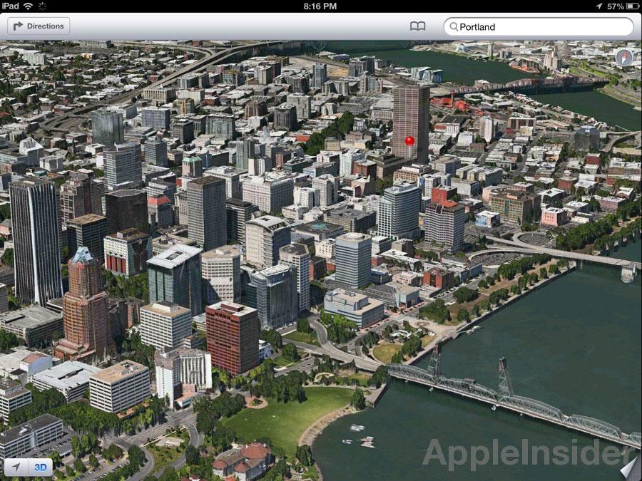
So far, there are a limited number of cities that have fully modeled support, but the infrastructure is in place to deliver a Flyover experience anywhere. Apple is also reportedly adding support for new cities (like Portland, Oregon, below) at a regular clip. There's also a technology curve that taxes the resources of even the newest iOS hardware, but things can only improve as mobile devices get faster.
Google (among others) is also deploying its own 3D mobile maps, and would realistically be expected to be far ahead of Apple given its distant head start in mapping and 3D modeling with Google Earth. However, developers report that Google's 3D maps are in many cases inferior to the developer builds visible in Apple's iOS 6 Maps app.
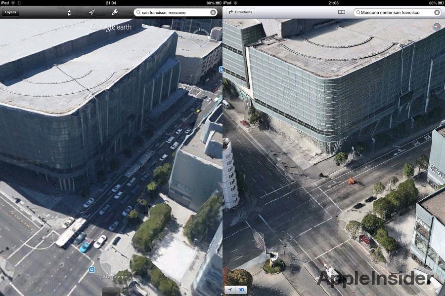
View of Moscone Center in Google Earth (left) and Apple Maps (right)
Additionally, Apple is already providing models for areas Google hasn't yet, such as this view of San Francisco's Treasure Island, where Google Earth simply presents the map rendered as a flat surface (which Apple also does in areas where there are not yet models).


3D model view
If Flyover's full 3D modeling seems too graphically intensive for today's hardware, consider instead the highly efficient 3D model mode in iOS 6 Maps' standard street view.
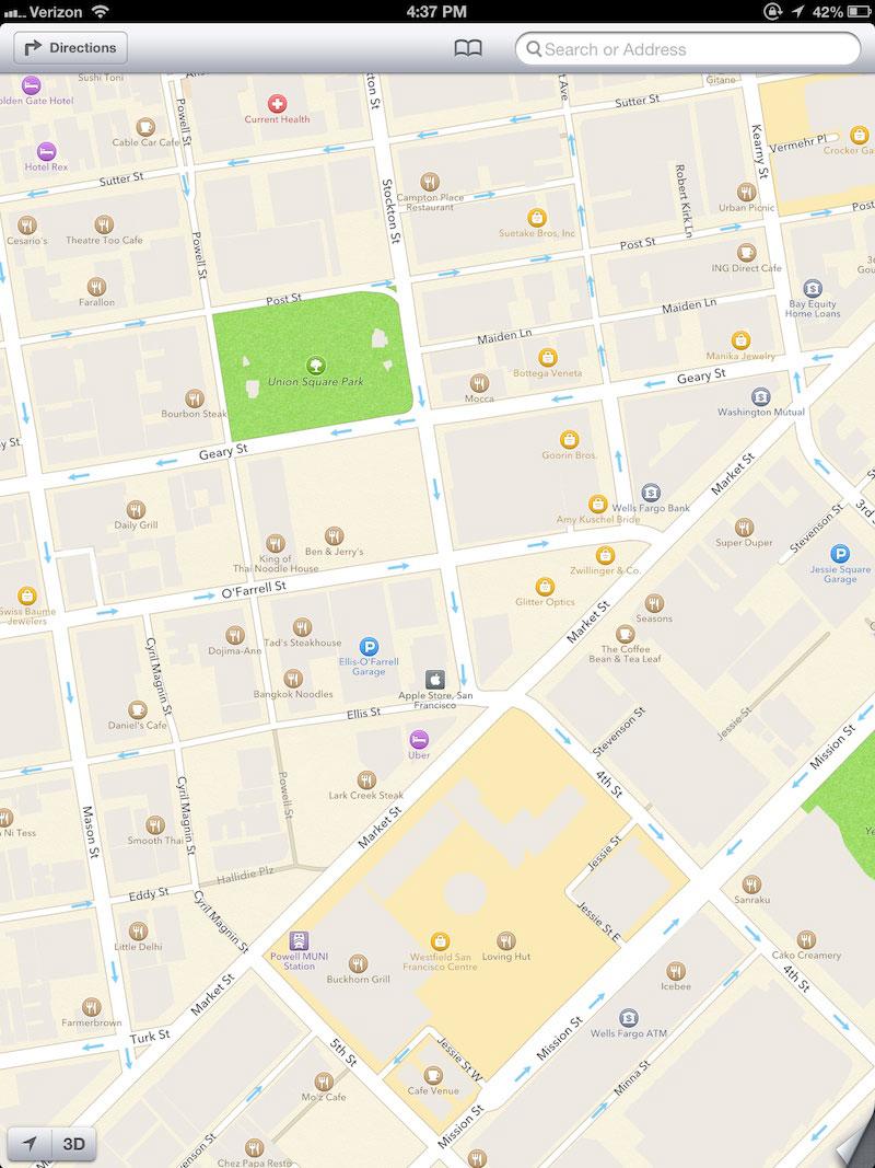
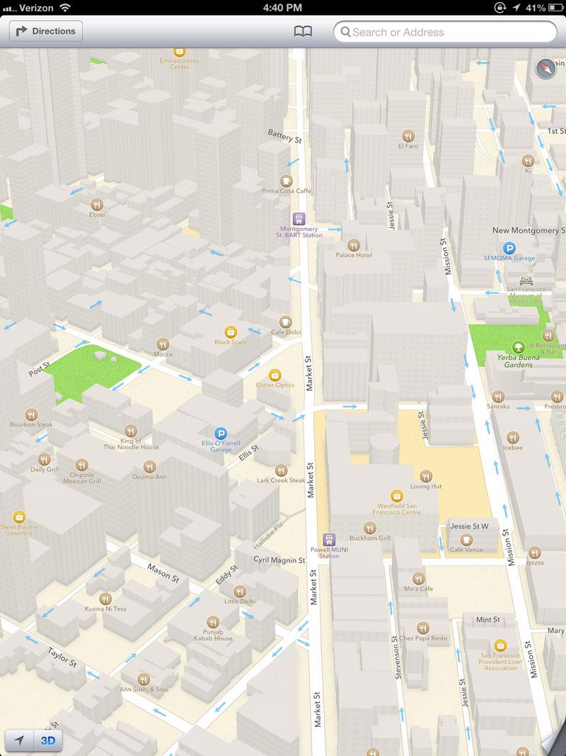
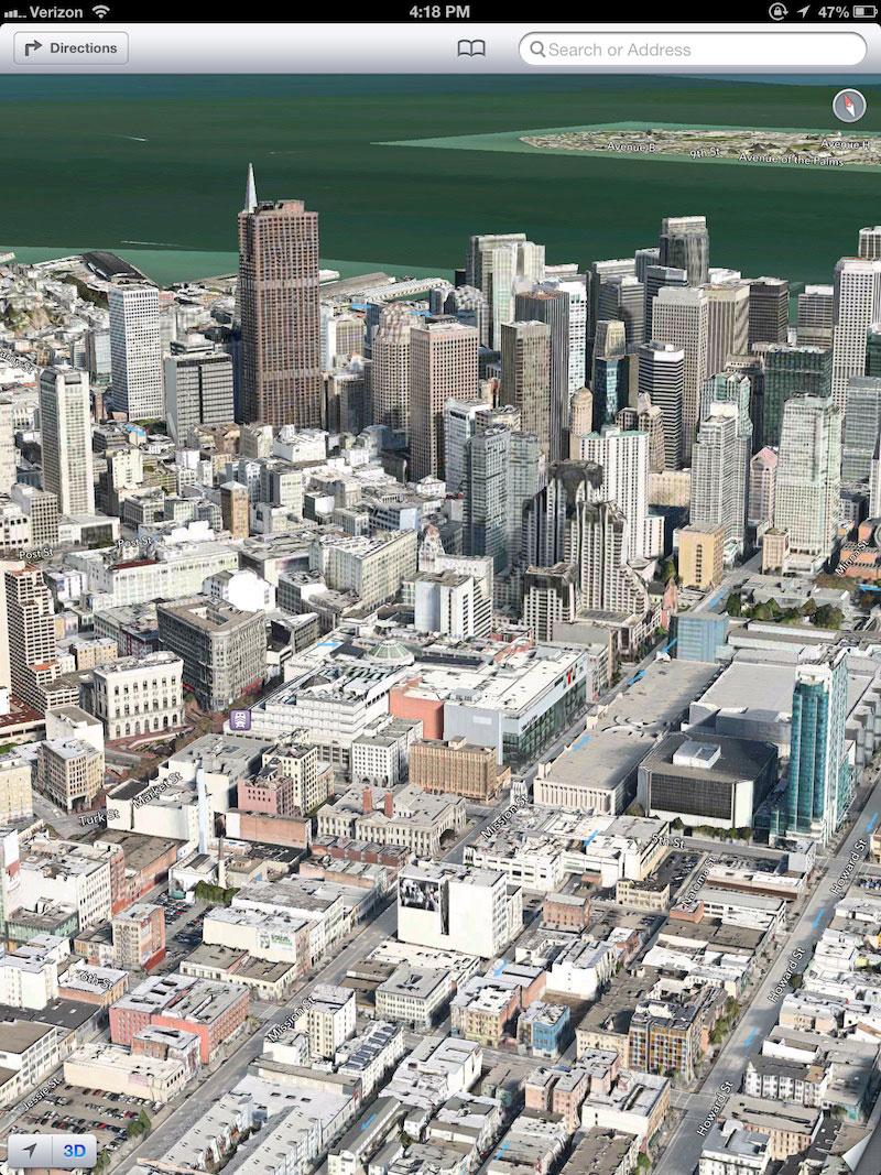
When viewing a location top down, you get a view similar to that provided by the current Google Maps server, except that building masses are rendered as 2D outlines rather than as flat 3D with a slight perspective effect. Below, San Francisco's downtown Union Square area in standard 2D.
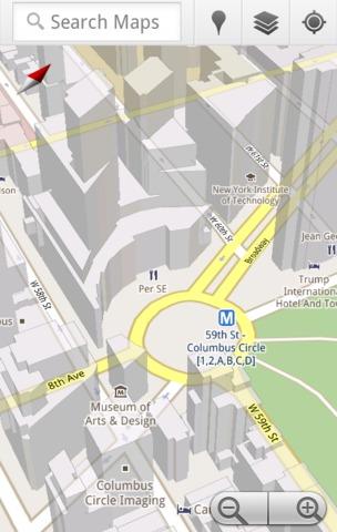
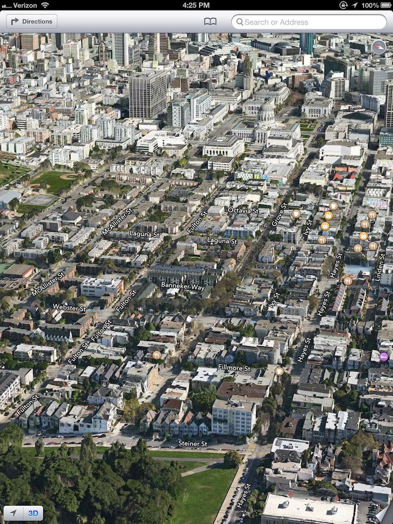
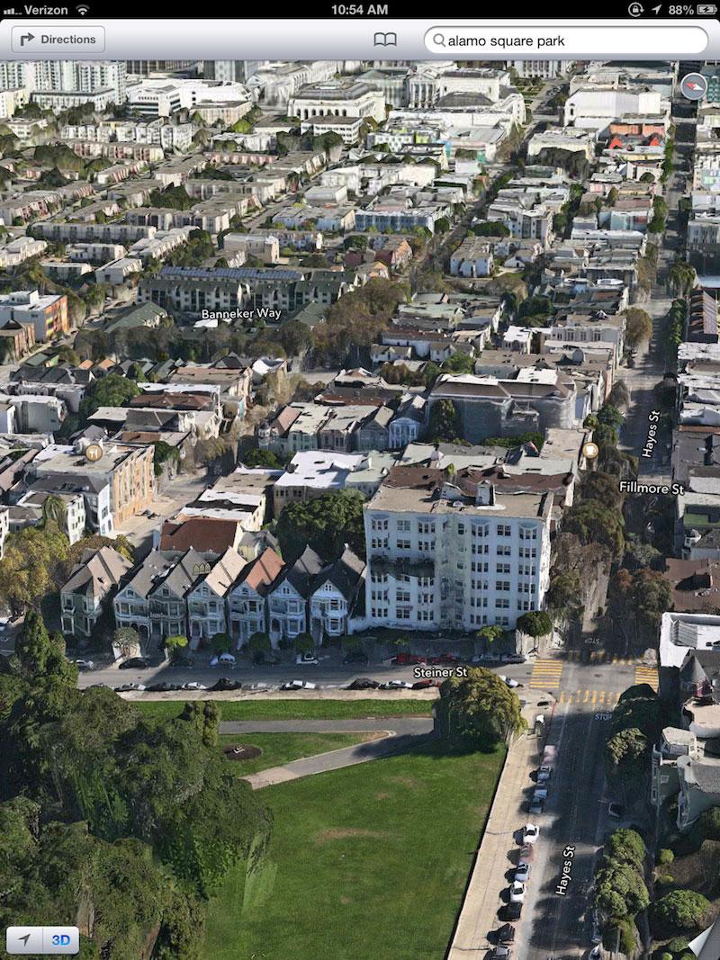
You can touch the 3D button to get a perspective view, where buildings and other structures pop up from the surface of the map. Drag two fingers up or down and the perspective changes from straight down to about 45 degrees downward. Below, the same view as above, but in standard 3D.

Spin the map with two fingers and you can look down actual street corridors, very similar to the views in Google Earth. Of course, building models only exist for a limited number of major cities. Even in areas where there are not yet models, 3D views of Map's 2D vector outlines provide an additional level of perspective from an airplane-like view. Below, the same map, rotated to look up Market Street.
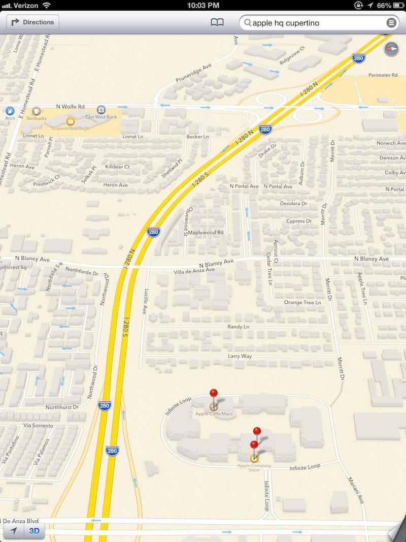
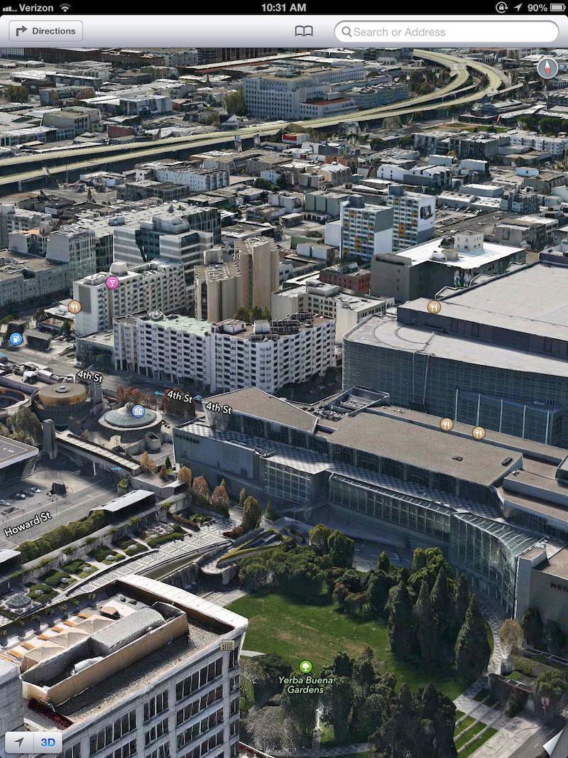
Where building models do exist, 3D "standard view" provides a useful overview of what a neighborhood's structures look like. It isn't really comparable to StreetView, but it is a very fast and responsive way to explore around neighborhoods. Below, Apple's Cupertino campus in standard 3D mode.
On page 3 of 3: 3D Flyover with satellite images, and which is creepier?
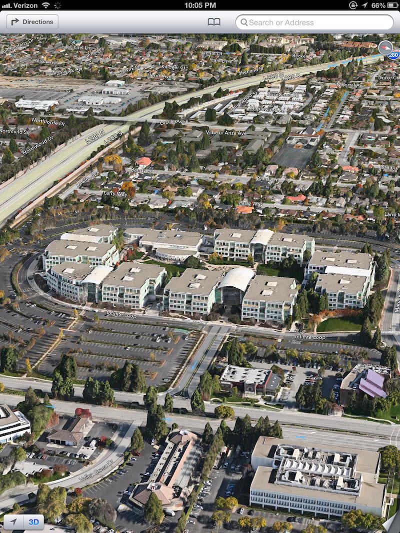
Add in photo surface textures and of course rendering slows down, but things also get very interesting. While Google's StreetView can be used to zoom into a particular block face, looking into a house's windows, Apple's Flyover approach provides a more "estimated" view, essentially a distorted depiction of an aerial photograph. Below, the same map view above, but with satellite images turned on, and below that, zoomed in to the Apple campus.

Flyover certainly isn't the same as StreetView; the detail is rougher and often morphed or distorted. Apple doesn't have to blur faces or license places in Flyover because you can't make out details at that level anyway. However, Flyover provides a more continuous view of an area, and lets you observe it from an omniscient vantage point, floating upward or spinning the earth below you.
As you zoom around, Flyover loads estimated buildings and fills in details as needed, accounting for the rendering speed of your device and the throughput of your mobile network.
Like StreetView, Flyover provides an idea of what an area looks like before you get there. Unlike StreetView, it's not tied to a series of points along primary streets, and there's rarely a case where your StreetView is blocked by a passing truck or other street level obstructions (as often occurs to Google's street view camera vehicles).
Which is creepier?
Flyover also allows you to see the backside of buildings, down alleys, and explore open spaces that Google can't reach from its StreetView vehicles. Unlike StreetView, with Flyover you (and anyone else!) can explore your own backyard. Or, for example, the exclusive rooftop deck of the Paramount at Yerba Buena Gardens, where Apple hosts its WWDC after party.
However, with Flyover, you're getting a massaged version of what is essentially aerial photography mapped to structure dimensions. StreetView shows what someone driving through your neighborhood would see: clear details of the front of your house, cars, pedestrians and so on, details that have generated significant controversy.
Apple is less likely to incite the same response from privacy advocates because, while Flyover lets you see more, it also shows you less. You can't really spy in windows or see paparazzi-scale details. While both views are useful, StreetView is clearly more privacy-infringing simply due to its photographic realism shot from street-level spy cameras.
Flyover is unnerving in its own way, but it feels more like navigating a realistic map. Satellite and aerial images also raise some eyebrows among privacy advocates, but not to the same extent StreetView has. And Flyover is, essentially, just dynamic aerial imagery, essentially a product name Apple has applied to satellite maps when viewed from the 3D angle.
This also makes Flyover more discoverable as a feature, because it's tightly integrated into the view options of Maps rather than being a special view mode you have to manually enter.

Google Maps for iOS 6?
Until iOS 6 ships, we won't know whether Google will successfully introduce its own alternative Maps client for iOS users (it will likely want to) and whether Apple will approve it in the App Store (it may not, but Apple has already approved Google Earth, in addition to a variety of other apps it once held up on premise of "user confusion," including Google's Latitude and Google Voice).
If it does, Google and Apple will compete head to head on iOS in delivering vector maps, 3D views, turn by turn navigation and local information, although Apple will have a distinct home field advantage.
Not only is Apple's Maps app going to be the default, bundled option, but there's also no way to users (or an installed app) to specify a third party app as a default choice for handling maps. Further, Apple's iOS will direct all third party apps to the company's own servers when they make mapping API requests to draw a map in their own apps.
Besides vectors, 3D models and Flyover, there's another new technology angle Apple will be leveraging in its own iOS 6 Maps app, which will be discussed in a forthcoming segment.


 Amber Neely
 Thomas Sibilly
 AppleInsider Staff
 William Gallagher
 Malcolm Owen
 Christine McKee


171 Comments
The problem with Apple's approach is this: In everyday life, how often are you looking for a place in "the big city" versus some place "around town"? I'm not talking about living in the sticks, I'm talking about the difference of living just a few miles away from downtown.
When you are looking for visual landmarks in these areas, there are no 3d models or views and, without them, the 2d map image quality is substandard (lower resolution satellite imagery than what we had with Google maps). So how, exactly, is that going to be better?
I REALLY hope the 2d map image data improves in quality before the release. Speaking as someone who uses his iPhone for geocaching, it is clearly a step backwards in terms of image quality right now.
Sorry, I still think street view is much more useful.
This topic was discussed on one of Gruber's Podcasts a few weeks ago. I agree with the argument for including a "Street View" feature in maps. In general, most people don't visualize the world in "birds-eye" view. We walk on the ground and view things from street level. How many people do you know that have been totally lost when looking at paper map? There were other points being made for a street view, but you'll have to listen to the podcast for that.
Here's a couple examples of why street view might be more helpful than fly-over:
Granted my points here aren't that strong, but you get the idea.
Wow, I never knew you could do street view in the current maps app. Way to hide that one on us Apple!
"...aim to be more helpful, less creepy than Google Street View".
I don't even need to look at who wrote this - I know.
Why include 22 full-size pictures directly in the article? This article took about 10-minutes to load.
Pro-tip: Include low-res picture previews that link to the full-size pictures next time...