Days before the South by Southwest festival is set to kick off, Apple Maps has added public transit information to the host town of Austin, Tex., benefitting the tens of thousands who will descend upon the city.
Multiple AppleInsider readers reached out on Tuesday to reveal the silent update added by Apple. Austin marks the first added city since Apple launched transit directions in Los Angeles, Calif., last December.
SXSW 2016 kicks off this Friday in Austin, and runs through March 20.
In terms of city availability, data remains extremely limited in Apple Maps when compared to competitors such as Google Maps. When it launched with iOS 9 last year, Apple Maps transit was available in Baltimore, Berlin, Chicago, London, Mexico City, New York City, Philadelphia, San Francisco, Toronto, Washington D.C., and 30 cities in China, including Beijing, Shanghai and Shenzhen. Maps were also added to Boston and Sydney in October.
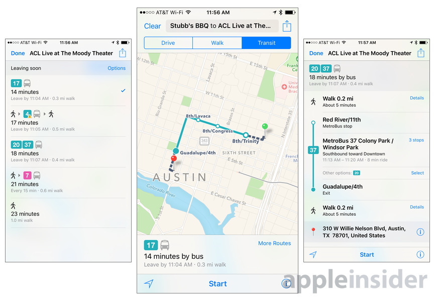
With transit, Apple Maps in iOS 9 offers routes, departure times and other relevant data for buses, trains, ferries and other forms of public transportation. The solution is akin to Google Maps, which has for years provided users with transit routing tools.
In addition to local schedules, transit in Apple Maps gives users a top-down view of underground subway and train stations, a feature unique to Apple's service. Armed with track and time information, commuters can more efficiently plan their routes without getting lost. Further, data is customized for each location, meaning road signs are as they appear in real life.
Apple's Transit feature is made possible by technology gained through key acquisitions like HopStop and Embark, powered by a multitude of data sources specific to each supported location.