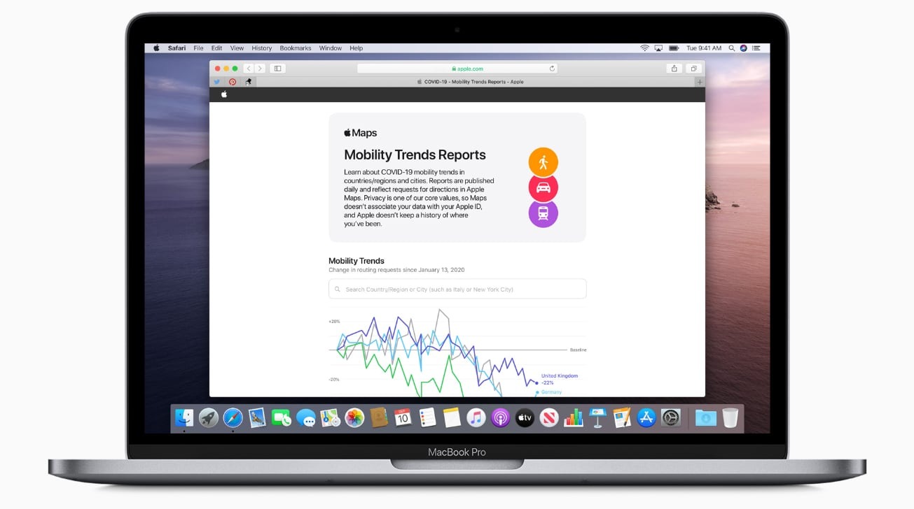
Apple has begun publishing interactive Mobility Trends Reports derived from anonymized Apple Maps data requests in an effort to demonstrate how people worldwide are changing their travel habits and staying indoors during the ongoing COVID-19 pandemic.
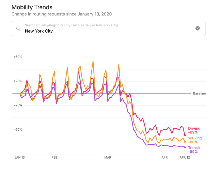
Revealed on Tuesday, the page within Apple's COVID-19 site offers users with line graphs showing requests for directions in Apple Maps. Rather than showing actual request figures, the chart instead indicates changes in the number of requests made over time, allowing for percentage-based comparisons between populations.
The default view for the chart offers results for the United States, UK, Germany, and Italy, with a search box allowing users to narrow down data by country, region, or city. Drilling down to a specific area also refines the chart so instead of showing a general change in results, it narrows down results into Driving, Walking, and Transit categories.
Along with the graph, the page also offers the complete data set as a download, complete with daily changes in requests by transportation type, covering all available countries, regions, and cities.
The chart's ultimate aim is to "provide helpful insights to local governments and health authorities" impacted by the coronavirus pandemic, "and may also be used as a foundation for new public policies by showing the change in volume of people driving, walking, or taking public transit in their communities."
Apple is keen to stress how it is ensuring user privacy for the chart, which includes aggregating data before putting it into the chart so it reflects a region's activity, not an individual. "Data collected by Maps, like search terms, navigation routing, and traffic information, is associated with random, rotating identifiers that continually reset, so Apple doesn't have a profile of your movements and searches," the company states.
While protecting your privacy, we are sharing aggregated mobility data from Apple Maps to help public health authorities learn how people travel in their communities and to provide valuable insights to stop the spread of COVID-19. Stay safe and healthy! https://t.co/Nok77HKIXN
— Tim Cook (@tim_cook) April 14, 2020
The results are separate from the joint effort between Apple and Google to perform contact tracking with apps, developing APIs that use Bluetooth to identify if people have been in close proximity to those who may be carrying the virus, while still ensuring user privacy.
Apple has simplified the process for healthcare providers to add listings to Apple Maps to show where COVID-19 testing sites are located. Default searches within Apple Maps have also been updated, pointing users to services they are more likely to request during the period of social distancing and stay-at-home orders.