Continuing an apparent acceleration in the rollout of Apple Maps Transit data, Apple recently activated public transit directions across West Virginia, granting users in major metropolitan areas access to bus, tram and rail information.
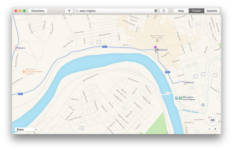
Not yet noted on Apple's iOS Feature Availability website, Transit directions are now live in select West Virginia municipalities including Charleston, Fairmont and Morgantown.
In the state capital of Charleston, Maps integrates bus data from Kanawha Valley Regional Transportation Authority and TriRiver Transit, while directions in Fairmont are backed by data from the Fairmont-Marion County Transit Authority. Morgantown pulls information from Mountain Line Transit, Buckwheat Express and Morgantown Personal Rapid Transit, the latter being a tram system connecting three West Virginia University campuses.
The usual assortment of navigation options are available to users in the area, including arrival and departure times, route creation tools and local service advisories.
Apple's public transportation mapping feature was deprecated from Maps when the company abandoned Google Maps in iOS, but the function returned with the release of iOS 9 in 2015. Instead of outsourcing the project, Apple built its own Transit feature in part with technology acquired through purchases like HopStop and Embark.
Like other popular transit tools, Apple Maps Transit provides routes, departure times and other relevant data for buses, trains, ferries and other forms of public transportation. Apple adds its own flourish with top-down views of select underground subway and train stations, complete with entrances and exits for quick on-foot navigation.
Following a limited launch in the U.S. and China, Transit rolled out to the UK and Japan in 2016. The service arrive in Paris, Singapore, the Netherlands and Adelaide, Australia last year.
Most recently, Transit went live in Orlando, Fla., and Arkansas last week.
 AppleInsider Staff


 Malcolm Owen

 William Gallagher


 Wesley Hilliard



 Christine McKee




-m.jpg)



6 Comments
Here's the directions to find that country road, take me home, mountain momma.
I just found out that Apple Map has 'Ride' feature, which listed down all the Lyft and Uber options including time waiting and fee of each. This is a feature that I am going to use a lot in LA next month.
Do these seem to be coming in faster or is it just me ?
West Virginia and public transit? Perhaps a sign Apple has nearly the continental US covered ;)