Apple has enabled public transit data in Apple Maps for users in Orlando, Fla., providing residents and visitors using the mapping service with more information about bus routes, times, and service updates across the metropolitan area.
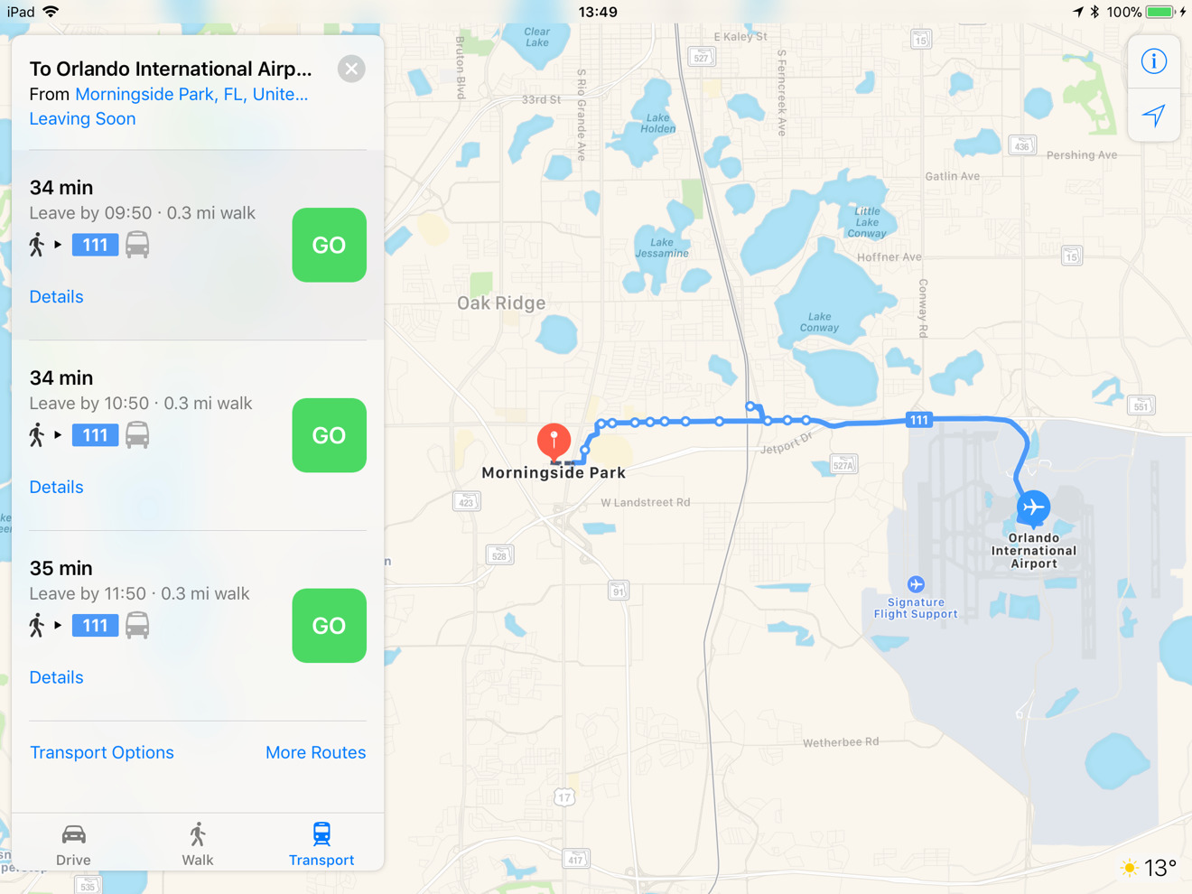
The new Transit data adds information to Apple Maps relating to Lynx bus stops and routes taken by public transport. Searches for bus stops will bring up a list of the routes that pass by and when the next bus will stop at that location, with the overall route the bus will take also viewable.
Planning a route using public transport will show the bus routes needed to be taken, the times of each stage of the journey, and any sections where walking is required. Searches will also warn of any changes to the bus services in realtime, including temporary rerouting, which is taken into account when Apple Maps offers navigational instructions.
The data used by Apple Maps for Transit covering the area is supplied by the Central Florida Regional Transit Authority, the operator of the Lynx bus service.
At the time of publication, Apple has yet to update its iOS Feature Availability website to reflect the addition, with Orlando missing from the list of Transit-enabled areas.
Apple has gradually incorporated Transit data for a number of locations, making the app more useful as it competes against Google Maps and its similar public transport-related functionality. In 2018 alone, it has added public transport data to areas including Tucson, Ariz., Milwaukee, Wis., Omaha, Neb., and major areas of South Carolina, with bus, train, and streetcar operations in Tampa, Fla. added in December last year.
Earlier this week, Apple Maps started showing the locations of bike-sharing services in over 175 cities in 36 countries, using a feed compiled by Ito World. A search of Apple Maps reveals listings for bike sharing stations are available in Orlando.
Apple also added indoor mapping data for 34 major airports and large malls in December, to help with navigation within the large buildings.